
Landsat Dynamic Surface Water Extent Example

Detailed Description
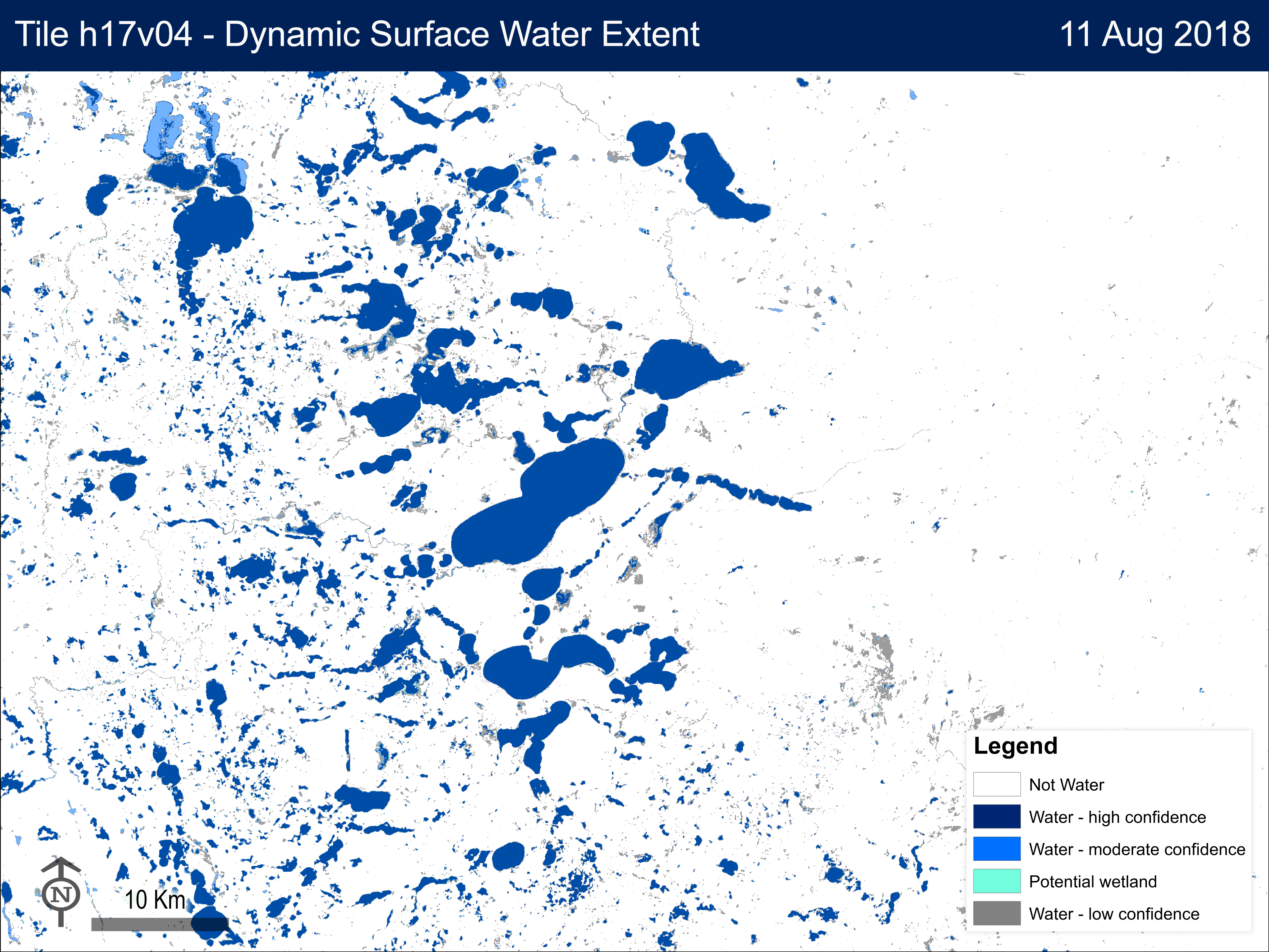
Landsat Dynamic Surface Water Extent Science Product example from Northern Minnesota.
This data set represents the existence and condition of surface water at the time of Landsat acquisition. It can be served as input to hydrologic and carbon models, as well as other Landsat Science Products such as Burned Area or Fractional Snow Covered Area. Application research includes topics such as habitat assessment, wetland delineation and monitoring, flood mitigation and recovery, and land cover.
Data Set AttributeAttribute ValueDSWE Tile IdentifierLC08_CU_017004_20180811_20181125_C01_V01Acquisition Date2018/08/11Spacecraft IdentifierLANDSAT_8Sensor IdentifierOLI/TIRSNorth Bound47.4260594363South Bound46.0605324627East Bound-94.2295292476West Bound-96.2053039949
Sources/Usage
Public Domain.