
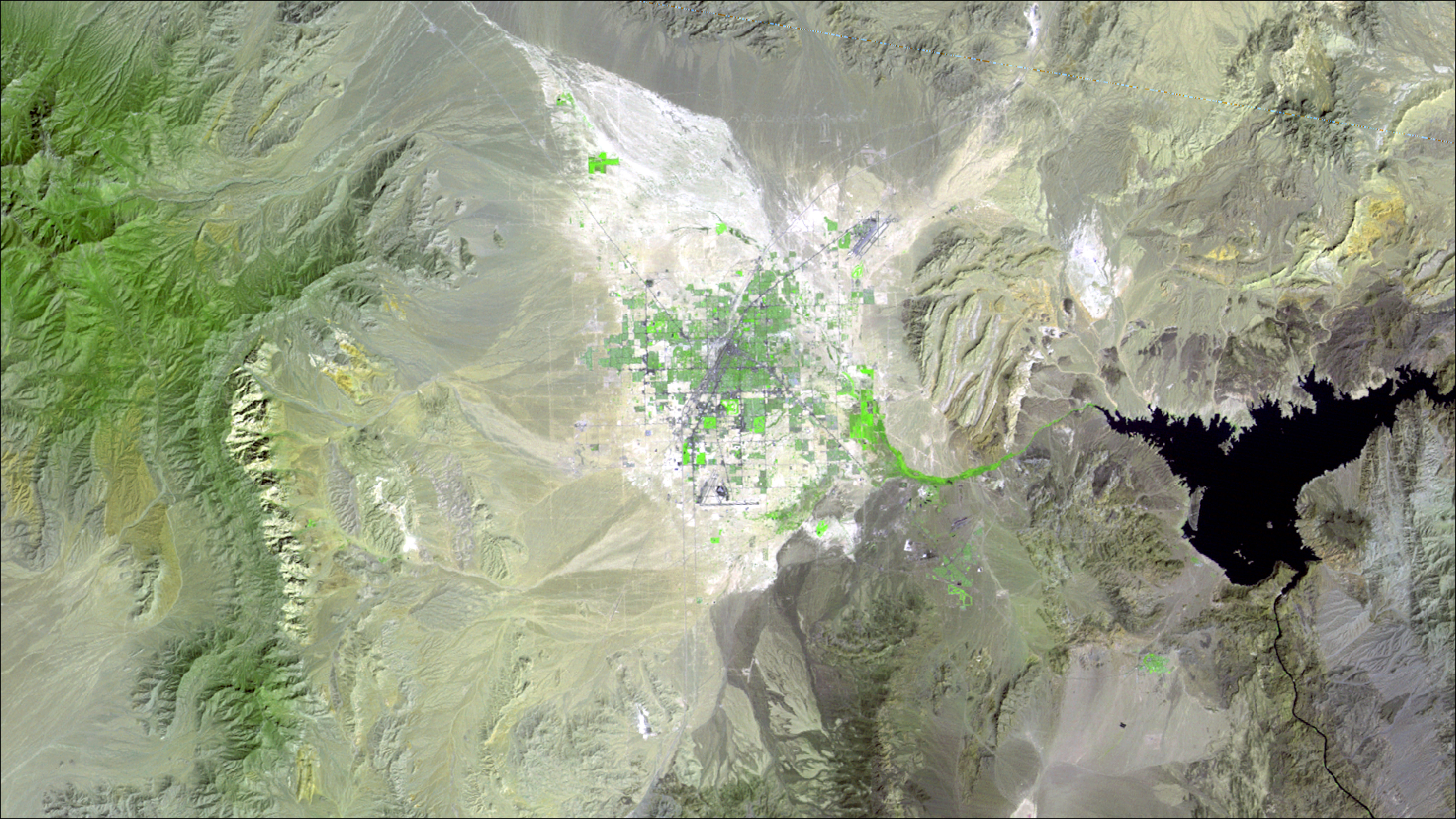
Las Vegas, 1972

Detailed Description
This false-color Landsat 1 image, acquired on September 13, 1972, shows the Las Vegas metropolitan area in southern Nevada shortly after the launch of the first Landsat satellite. Lake Mead is visible east of the city, while the surrounding Mojave Desert and mountain ranges dominate the landscape. The image combines near infrared, red, and green wavelengths (bands 7, 5, and 4), causing healthy vegetation to appear bright green, water to appear dark, and urban and desert surfaces to appear in shades of gray, tan, and brown.
Sources/Usage
Public Domain.