
LiDAR-derived slope map of landslides, Yellowstone National Park
By Landslide Hazards Program
July 2023 (approx.)
Detailed Description
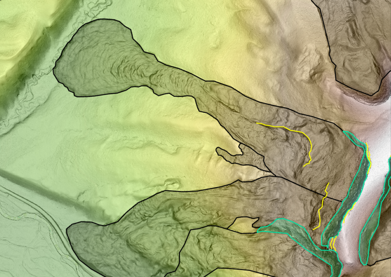
This is a LiDAR-derived slope map of multiple landslides at Lava Butte, adjacent to US Highway 191 in the northwestern corner of Yellowstone National Park. High elevations are brown and white, and green is lower elevation. Shading indicates steeper slopes. Black polygons are landslide deposits; teal polygons are head scarps of those deposits, and yellow lines are internal scarps. These deposits display the rocky head scarps and flow-type textures characteristic of many landslides throughout the park.
Sources/Usage
Public Domain.