



Location and Climate of Wolverine Glacier


Detailed Description
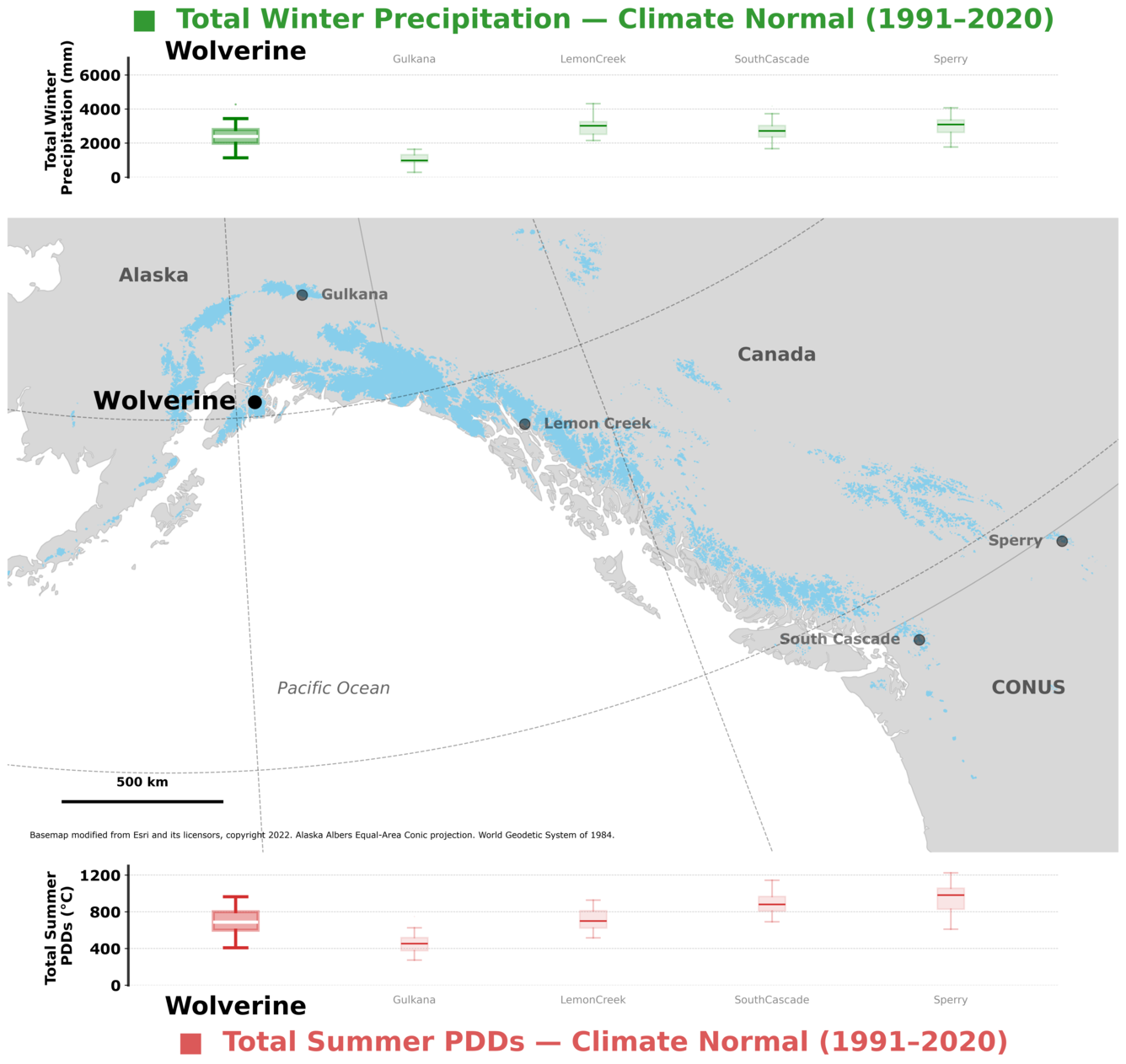
Figure 1: Top panel shows, Benchmark Glacier total winter precipitation at the median elevation of each glacier, based on local weather station data (O'Neel et al., 2019), for the 1991 – 2020 climate normal period. Map shows the location of Wolverine Glacier (large black dot) among the Benchmark Glacier network (smaller black dots). Glaciers of the Contiguous United States (CONUS), Canada, and Alaska shown in blue (Randolph Glacier Inventory, 2017). Bottom panel shows, Benchmark Glacier total summer positive degree days at the median elevation of each glacier, based on local weather station data (O'Neel et al., 2019), for the 1991 – 2020 climate normal period.
Sources/Usage
Public Domain.
Map produced by Chris McNeil (USGS)
Related

Wolverine Glacier
Wolverine Glacier is located in Alaska’s Kenai Mountains, along the western flank of Prince William Sound. Glacier observations began in 1966 and continue through present as the western most USGS Benchmark Glacier.
Related
Wolverine Glacier
Wolverine Glacier is located in Alaska’s Kenai Mountains, along the western flank of Prince William Sound. Glacier observations began in 1966 and continue through present as the western most USGS Benchmark Glacier.