
Map of 2018 groundwater levels in saprolite & fill, June 2018, NAWC NJ

Detailed Description
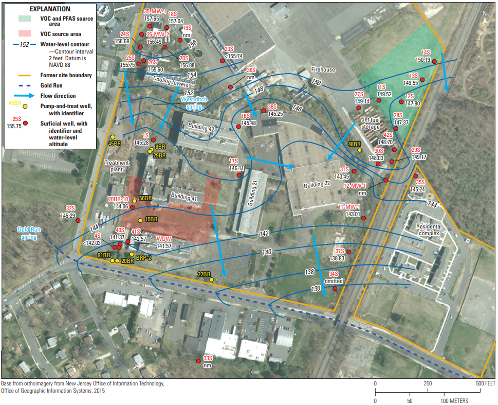
Groundwater levels, water-level potentiometric-surface contours, and groundwater-flow directions in the saprolite and fill at the former Naval Air Warfare Center, West Trenton, New Jersey, June 2018. Groundwater levels and contours are in feet. [VOC, volatile organic compounds, PFAS, per- and polyfluoroalkyl substances; NAVD 88, North American Vertical Datum of 1988]. This is Figure 4 in:
Fiore, A.R., and Lacombe, P.J., 2020, Groundwater levels and generalized potentiometric surfaces, former Naval Air Warfare Center, West Trenton, New Jersey, 2018: U.S. Geological Survey Open-File Report 2020–1016, 28 p., https://doi.org/10.3133/ofr20201016.
Sources/Usage
Public Domain.
Groundwater levels and generalized potentiometric surfaces, former Naval Air Warfare Center, West Trenton, New Jersey, 2018
Fiore, A.R., and Lacombe, P.J., 2020, Groundwater levels and generalized potentiometric surfaces, former Naval Air Warfare Center, West Trenton, New Jersey, 2018: U.S. Geological Survey Open-File Report 2020–1016, 28 p., https://doi.org/10.3133/ofr20201016.