
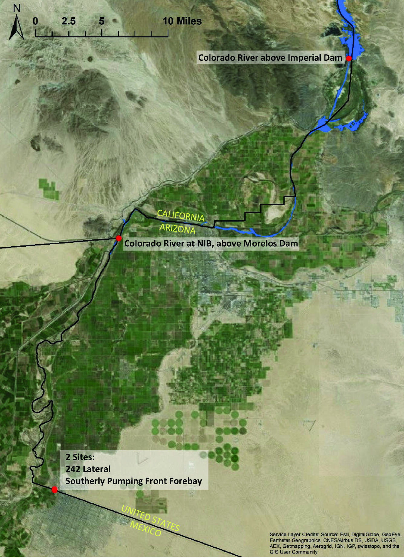
Map of the Colorado River between Imperial Dam and U.S – Mexico border
Detailed Description
Figure 1. Map of the Colorado River between Imperial Dam and the U.S – Mexico border, and approximate locations of proposed continuous salinity monitoring sites.
Sources/Usage
Public Domain.