
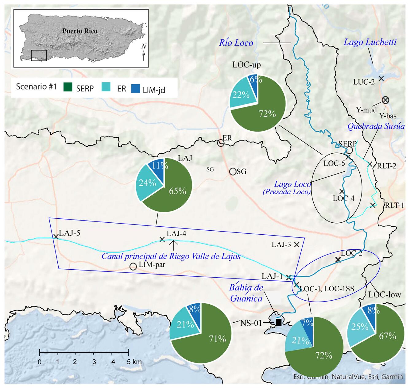
Map depicting Valle De Lajas and Río Loco drainage, Puerto Rico
Detailed Description
Map depicting Valle De Lajas and Río Loco drainage, the westernmost zone of the study area. Pie charts summarizing Sr isotope mixing model results. River sediment sample locations are represented by an X, bedrock sampling locations by open circles. An infilled black rectangle shows Bahía de Guánica sediment sampling location (NS-01). Within the blue trapezoid in light blue is the Canal Principal De Riego Valle De Lajas. From the study Erosion and transport of sediments in watersheds of southwest Puerto Rico determined from strontium isotopes and mixing models.
Sources/Usage
Public Domain.