
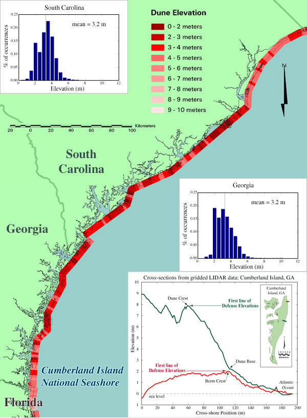
Map of dune elevation for coastal South Carolina and Georgia
Detailed Description
Map of dune elevation for coastal South Carolina and Georgia. On the either side of the map are histograms showing the distribution of these 'first line of defense' elevations, one for South Carolina and one for Georgia. An additional plot of cross-sections produced from gridded lidar data illustrates differences in vulnerability along Cumberland Island National Seashore (see bottom right hand corner of map). The first line of defense elevation of the red cross-section is nearly 6 meters below the elevation of the dark green cross-section.
Sources/Usage
Public Domain.
Related

Storm-Impact Scale
The potential vulnerability of a particular stretch of coast can be assessed using a conceptual model that scales the impacts of storms on barrier islands.
Related
Storm-Impact Scale
The potential vulnerability of a particular stretch of coast can be assessed using a conceptual model that scales the impacts of storms on barrier islands.