
Map of Greater Yellowstone Ecosystem Federal Lands
By Ecosystems Land Change Science Program
May 2021 (approx.)

Detailed Description
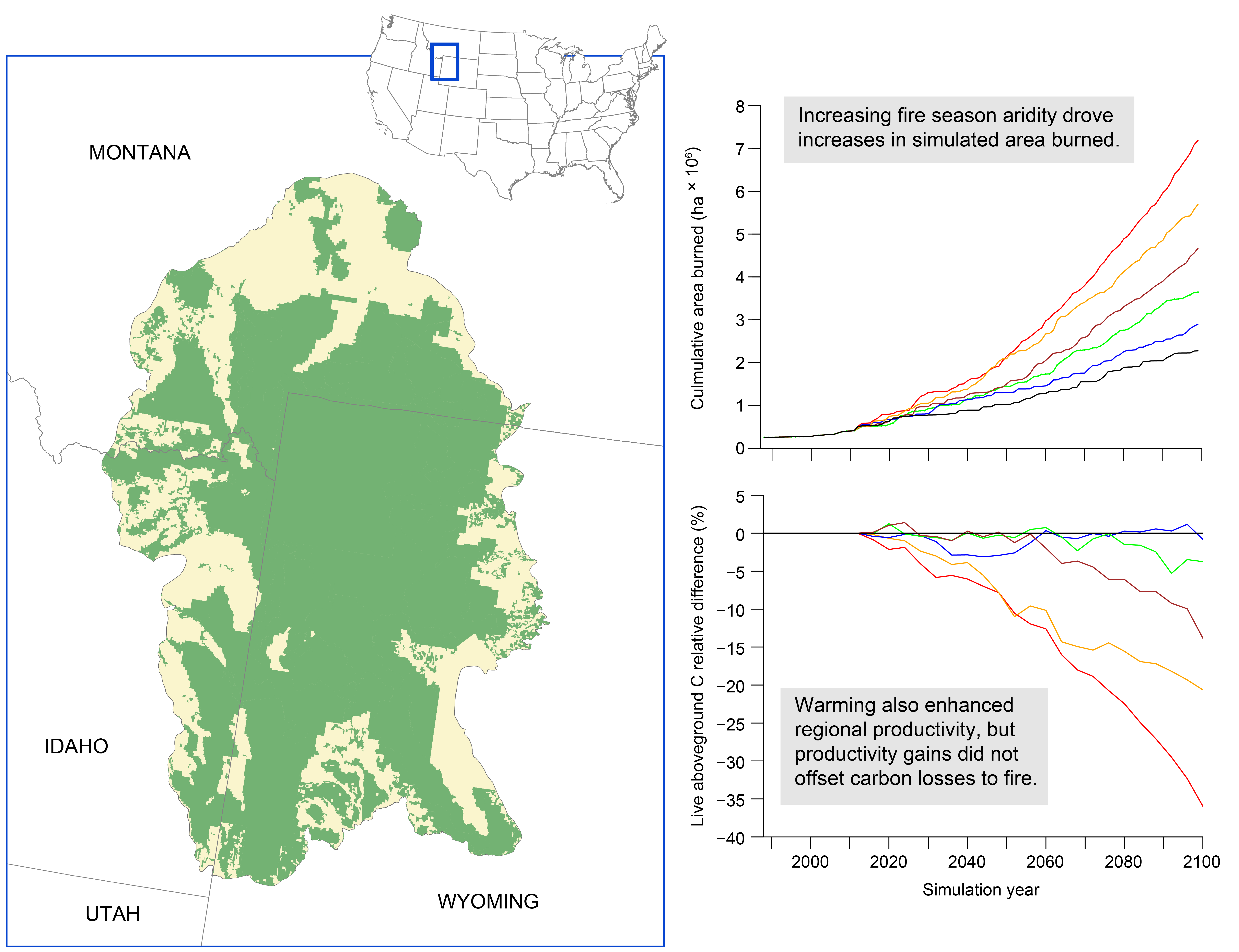
Left – Map of the Greater Yellowstone Ecosystem (GYE), which includes parts of Wyoming, Idaho, and Montana. Green areas denote federal lands managed by the United States National Park Service, Fish and Wildlife Service, and Forest Service. Yellow areas are held by tribal, state, and private land holders. Top right – Cumulative area burned simulated by the LANDIS-II model for 1988 – 2100 under historical climate conditions (black line) and climate projected by five general circulation models (GCMs) colored lines. Bottom right – The difference in carbon held in live aboveground biomass between simulations with historical and GCM climate.
Sources/Usage
Public Domain.