
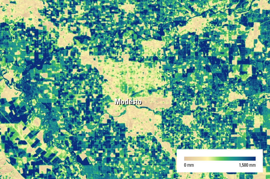
Map image of 2020 annual evapotranspiration (ET) in the Modesto, California, area
By Earth Resources Observation and Science (EROS) Center
2020 (approx.)
Detailed Description
Map image of 2020 annual actual evapotranspiration (ETa) in the Modesto, California, area, as determined by the SSEBop ET model from the USGS Earth Resources Observation and Science (EROS) Center. Urban and other developed areas tend to have less evapotranspiration than fields and other vegetative areas.
Sources/Usage
Public Domain.