
Map of river and stream crossings in Massachusetts
By New England Water Science Center
November 2022 (approx.)

Detailed Description
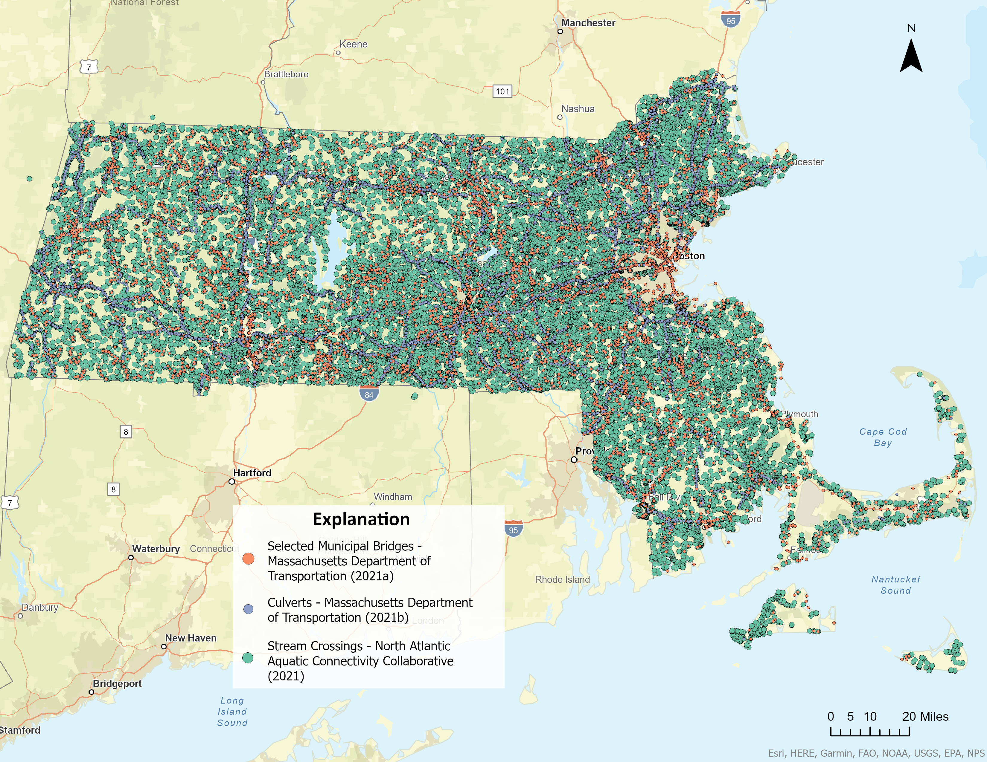
Map showing the approximately 25,000 river and stream crossings within the State of Massachusetts. Orange dots are Massachusetts Department of Transportation (2021a) selected municipal bridges, blue dots are Massachusetts Department of Transportation (2021b) culverts, and green dots are North Atlantic Aquatic Connectivity Collaborative (2021) stream crossings.
Sources/Usage
Public Domain.