
Map of uplift and earthquakes near Norris Geyser Basin, Yellowstone National Park, during 2024-2025
By Yellowstone Volcano Observatory
January 2026 (approx.)

Detailed Description
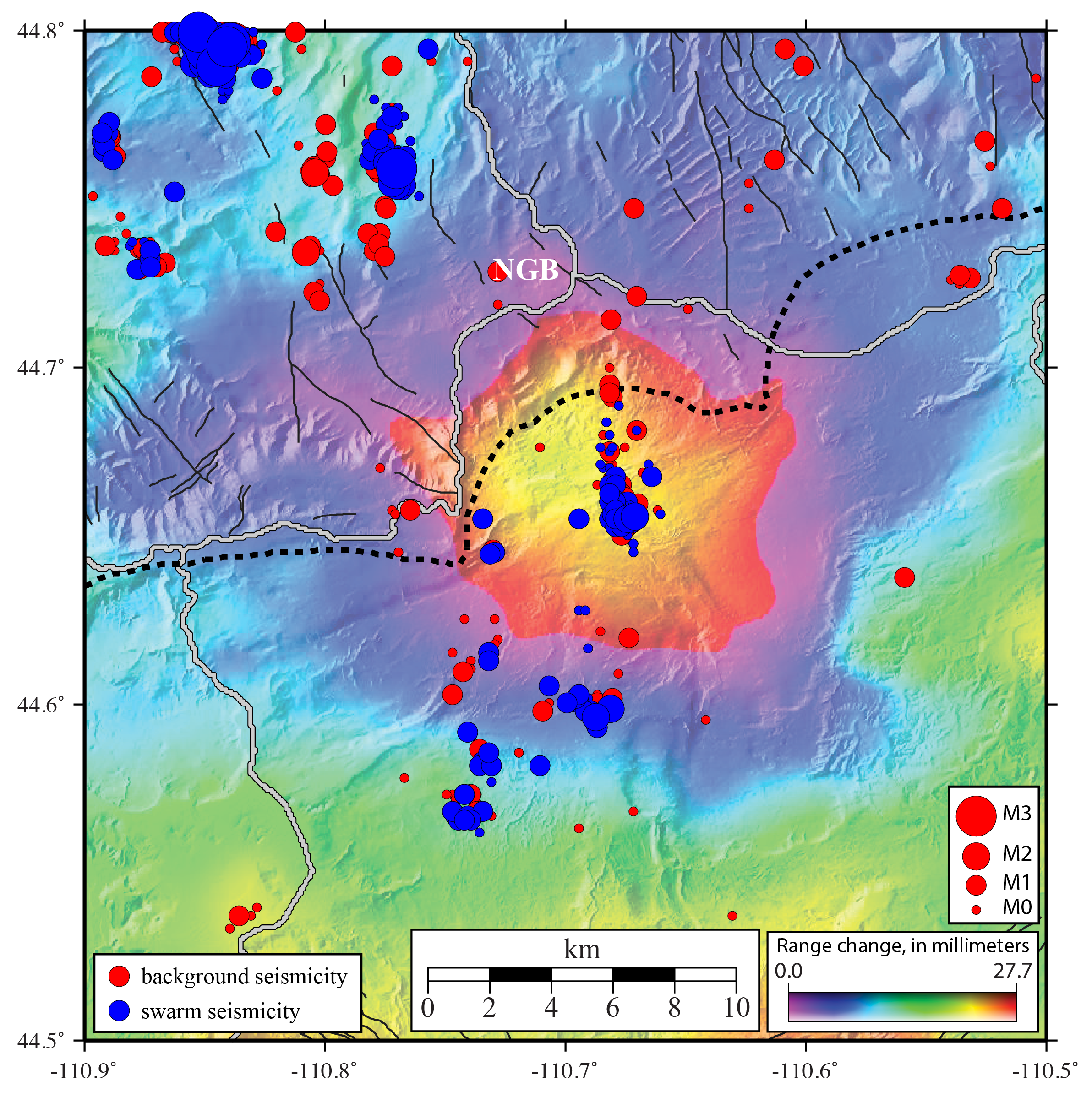
Map of uplift as seen by interferometric synthetic aperture radar (InSAR) covering the time between October 7, 2024, and October 2, 2025 (the uplift began in July 2025) along the north rim of Yellowstone Caldera to the south of Norris Geyser Basin (NGB). Plotted on top are earthquakes that occurred from the beginning of 2025 to late January 2026, with background seismicity shown as red circles and swarm earthquakes shown as blue circles. The largest swarm in that time occurred directly on top of the center of uplift in November 2025.
Sources/Usage
Public Domain.