
Mud Creek Shaded-Relief Topography, 2010-2017
Detailed Description
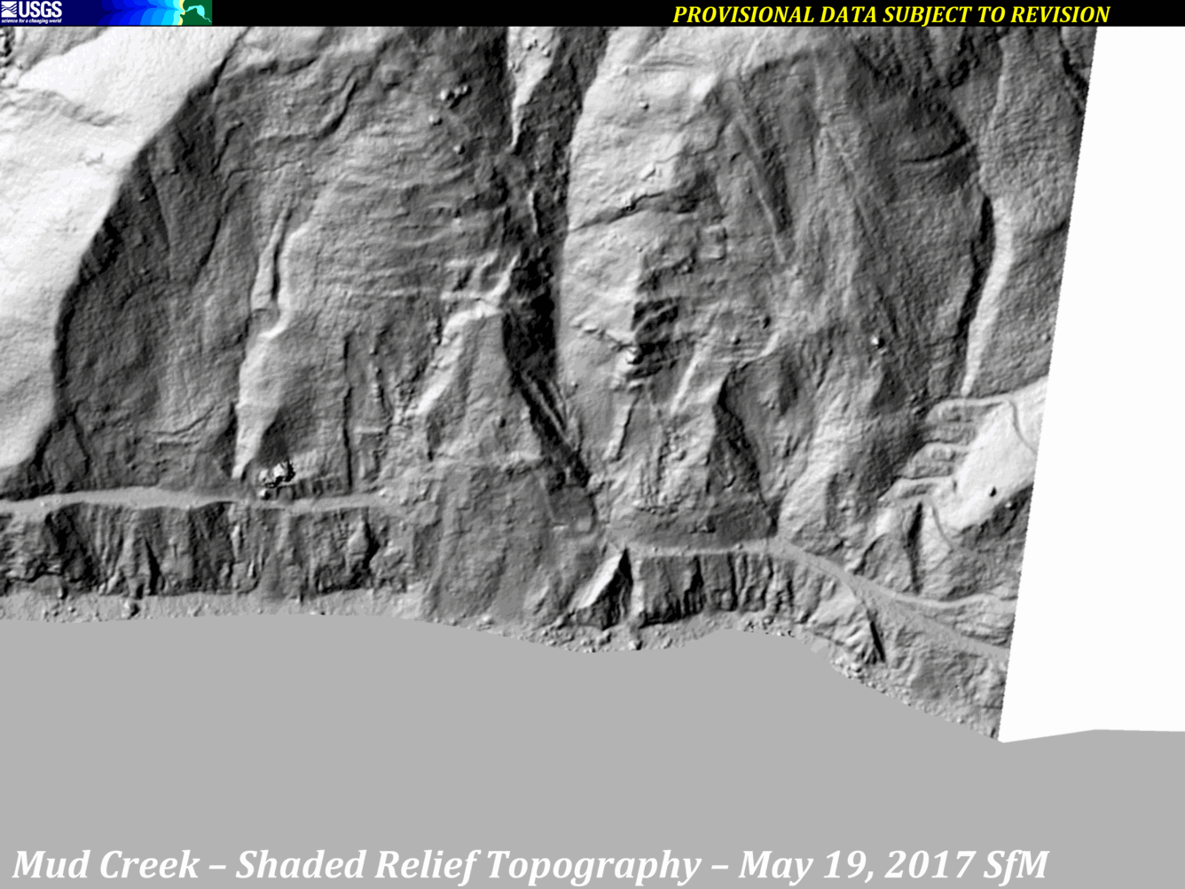
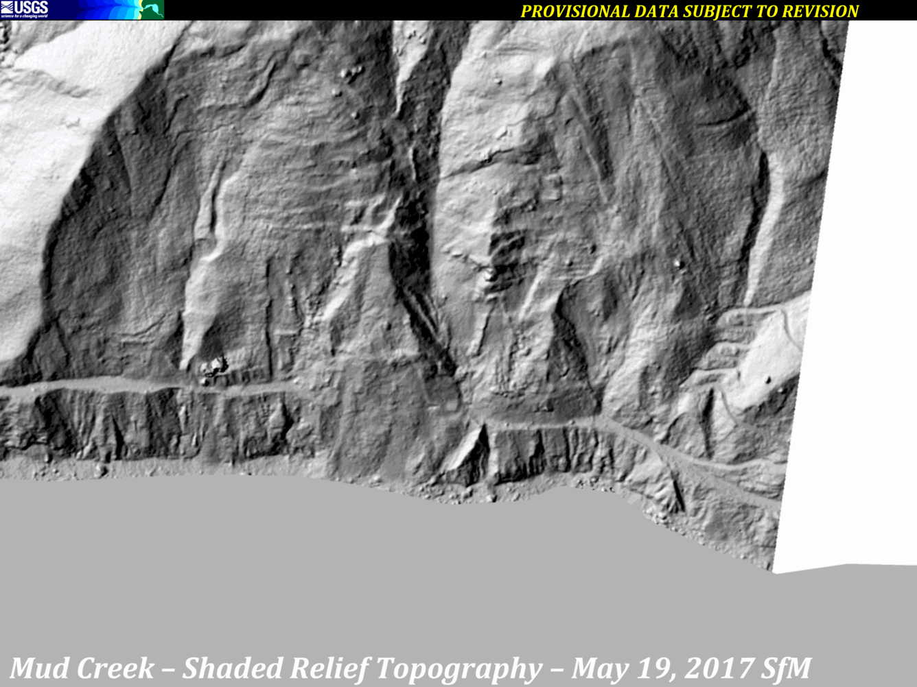
A series of images from various sources of shaded-relief topography show the progression of the Mud Creek landslide area, from 2010 through October 12, 2017.
Sources:
- lidar data from 2010
- lidar data from 2016
- structure-from-motion (SfM), March 8, 2017
- SfM, May 19, 2017
- SfM, May 27, 2017
- SfM, May 31, 2017
- SfM, June 13, 2017
- SfM, June 26, 2017
- SfM, October 12, 2017
Sources/Usage
Public Domain.