
New York Peak Flows - Stage and Discharge

Detailed Description
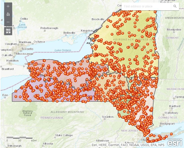
This map identifies locations (depicted as orange dots) in New York State where the New York Water Science Center has records of maximum recorded stages and discharges. Many of the locations have flood frequency statistics computed.
Sources/Usage
Related

New York Flood Information
For emergency situations, please contact Art Lilienthal, Surface Water Specialist at the USGS New York Water Science Center or call our general number (518) 285-5600 and follow the directions to leave voicemail which will be immediately forwarded to a responsible party and responded to as quickly as possible.
New York State Flood Investigations
Flooding can be a serious problem in many parts of New York State. Information on floods and analyses of flood data are needed to aid in the design of bridges, culverts, dams, highways, and buildings, and for the prudent management of flood-prone areas. Documentation of floods and a more thorough understanding of flood hydrology and hydraulics will result in more effective management of flood...
Related
New York Flood Information
For emergency situations, please contact Art Lilienthal, Surface Water Specialist at the USGS New York Water Science Center or call our general number (518) 285-5600 and follow the directions to leave voicemail which will be immediately forwarded to a responsible party and responded to as quickly as possible.
New York State Flood Investigations
Flooding can be a serious problem in many parts of New York State. Information on floods and analyses of flood data are needed to aid in the design of bridges, culverts, dams, highways, and buildings, and for the prudent management of flood-prone areas. Documentation of floods and a more thorough understanding of flood hydrology and hydraulics will result in more effective management of flood...