



October 1, 2026—InSAR image of Kīlauea deformation between September 11–27 and earthquakes September 30–October 1
Detailed Description
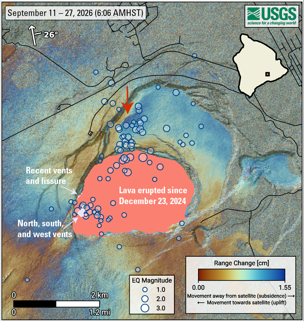
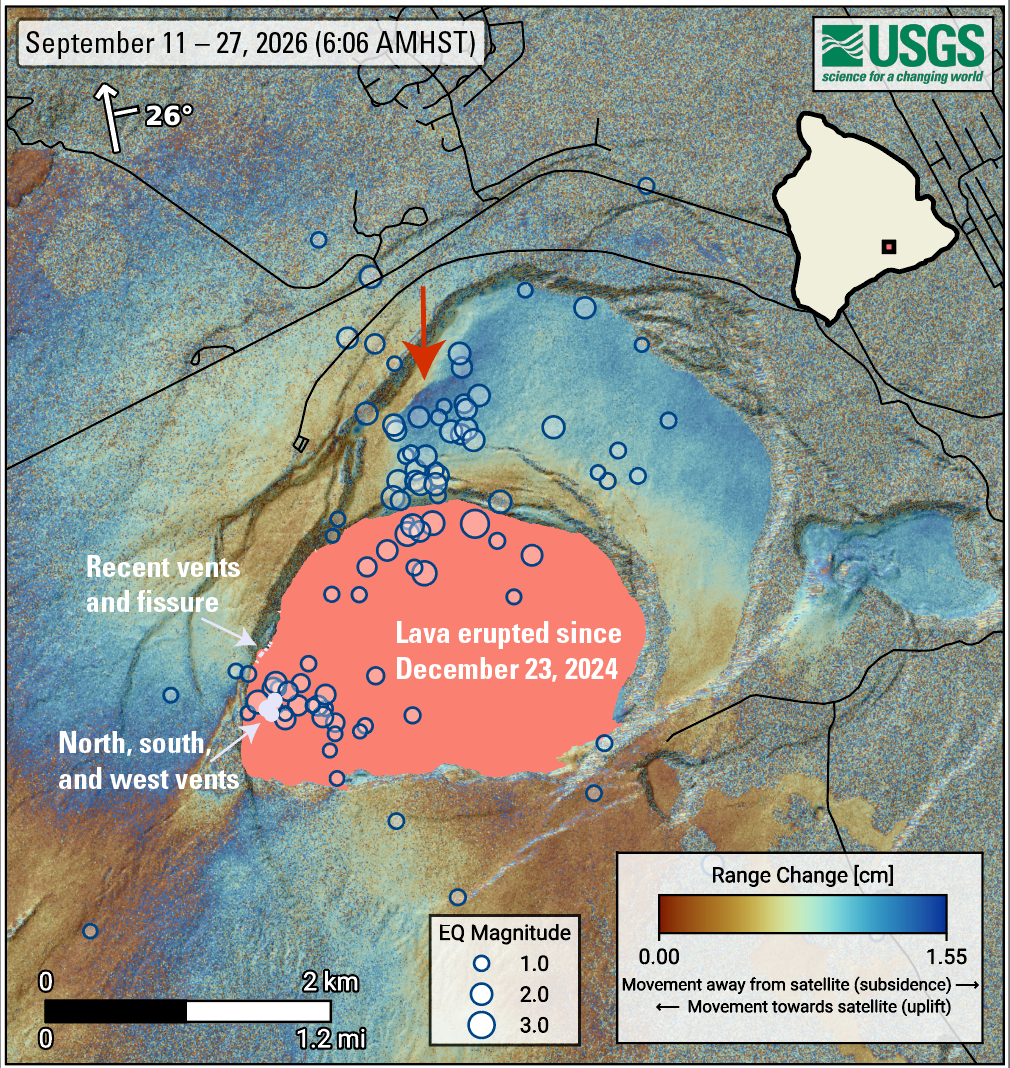
COSMO-SkyMed Second Generation (CSG) interferogram for the period from September 11–27, 2026, covering Kīlauea volcano’s summit region. The symbol in the upper left indicates the satellite's orbit direction (arrow) and look direction (bar).
Earthquakes recorded between 2 p.m. on September 30 and 8:30 a.m. on October 1, 2026, are marked with circles with the size proportional to their magnitude. Note that the time spanned by the interferogram and that of the earthquakes do not correspond.
The red arrow points at a discontinuity (sharp change in color) in the interferogram, which suggests surface fracturing and/or fault movement at the surface. While the amount of ground movement is very small (less than 1 inch), the discontinuity is clear. This feature is located near the seismicity recorded on September 30–October 1, 2026.
The lava flows covering the crater floor are represented by the pink polygon, the main vents (circles) and the new vents and fissures that opened September 14–16, 2026, (lines) are marked in white. Roads are marked in black.
Sources/Usage
Public Domain.