
October 7, 2022—Kīlauea summit eruption reference map
Detailed Description
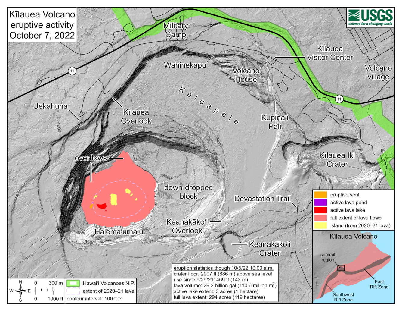
This reference map depicts the ongoing Kīlauea summit eruption on October 7, 2022. One eruptive vent (orange) is active within Halema‘uma‘u, on the western side of the crater floor. An adjacent pond (purple) is feeding lava to a larger lake (red) via a crusted-over tube. The eruption statistics provided here are current as of the last HVO overflight on October 5, 2022. Citizen scientists may notice that the eruptive features and statistics provided here are mostly unchanged from the last reference map on September 13, 2022. This is because a magmatic intrusion below Halema‘uma‘u on September 20, 2022, caused some lava to drain from below the crater floor. In the time since, lava has refilled to about the same level as before, and there have been no further ooze-outs to expand the footprint of lava flows from this eruption. Lava is presently visible from three public visitor overlooks in Hawai‘i Volcanoes National Park: Keanakāko‘i Overlook and Kūpina‘i Pali (Waldron Ledge) can see the eruptive vent and lava lake, while Kīlauea Overlook can occasionally see lava ooze-outs in the southeast part of the crater. Visit the park eruption page for more info: https://www.nps.gov/havo/learn/nature/september-2021-eruption.htm.
Sources/Usage
Public Domain.