
Photo and Video Chronology – Hawaiian Volcano Observatory – October 7, 2022
By Hawaiian Volcano Observatory
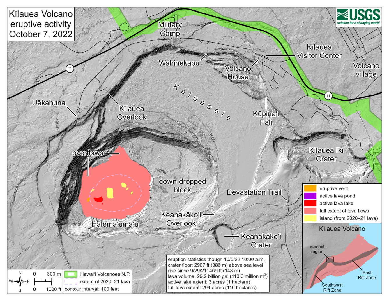
October 7, 2022
The eruption within Halema‘uma‘u, at Kīlauea's summit, began at approximately 3:20 p.m. on September 29, 2021.
HVO scientists collect detailed data to assess hazards and understand how the eruption is evolving at Kīlauea's summit, all of which are shared with the National Park Service and emergency managers. Access to this hazardous area is by permission from, and in coordination with, Hawai‘i Volcanoes National Park.
Recent Maps
Media

Sources/Usage: Public Domain. View Media Details
Media

Sources/Usage: Public Domain. View Media Details
Media
Sources/Usage: Public Domain. View Media Details
October 6, 2022
Media

Sources/Usage: Public Domain. View Media Details
Media

Sources/Usage: Public Domain. View Media Details
USGS has special use permits from the National Park Service to conduct official UAS missions as part of the Hawaiian Volcano Observatory's mission to monitor active volcanoes in Hawaii, assess their hazards, issue warnings, and advance scientific understanding to reduce impacts of volcanic eruptions. Launching, landing, or operating an unmanned aircraft from or on lands and waters administered by the National Park Service within the boundaries of Hawaii Volcanoes National Park is prohibited under 36 CFR Closures & Public Use. USGS photo by N. Deligne.
Media

Sources/Usage: Public Domain. View Media Details