
Palisades CA Post-Wildfire Lidar Data from Jan 2025
Detailed Description
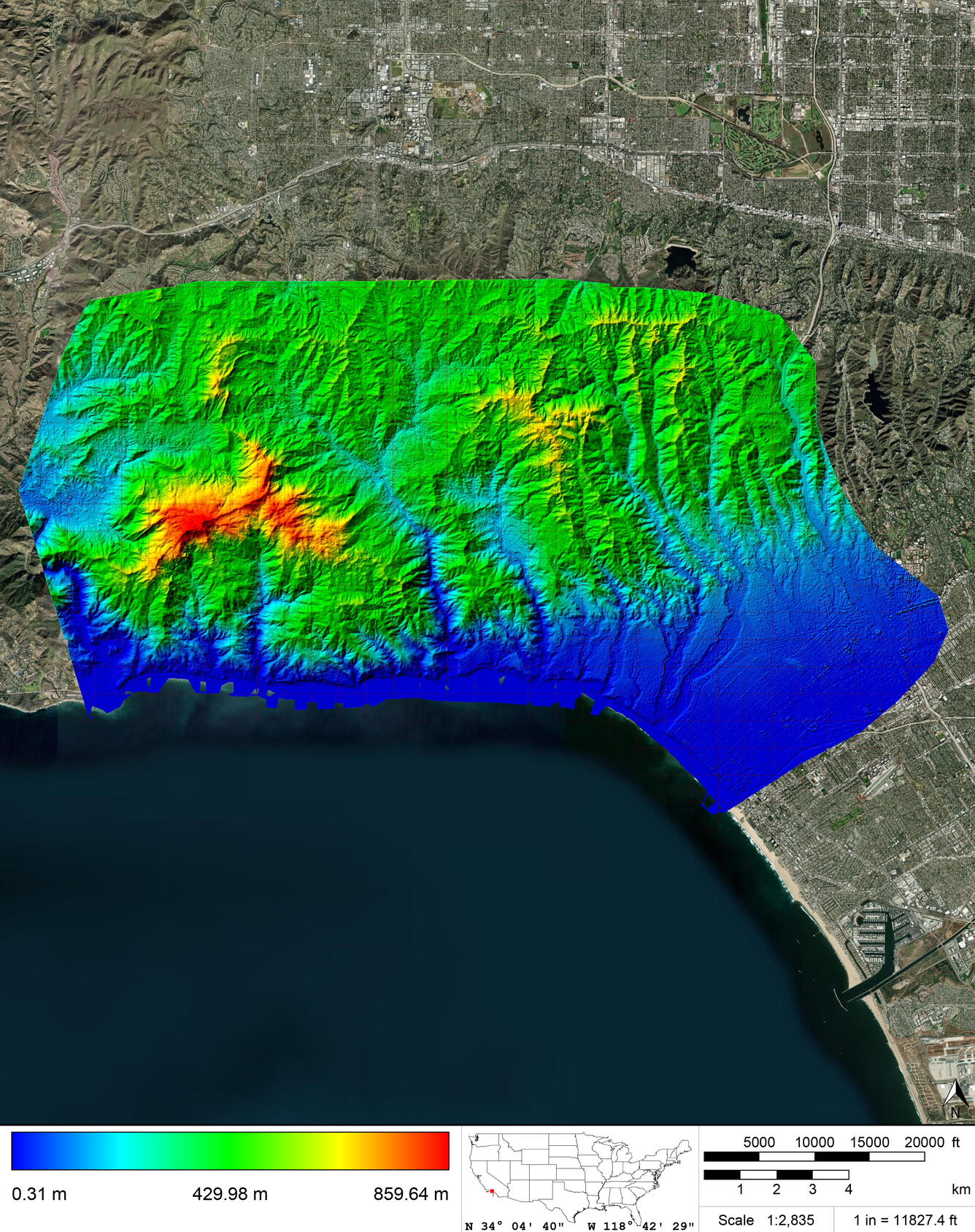
Digital Elevation Model (DEM) data for Response and Recovery as part of the Palisades wildfire in California. Class 2 (ground) LiDAR points were used to create the 0.5 meter Raster DEM symbolized with red to blue (high elevation to low elevation). DEMs have not been manually reviewed and should be considered preliminary. Geographic Extent: 1 counties in California, covering approximately 103 total square miles. Dataset Description: The Response and Recovery for the Palisades wildfire in California called for the planning, acquisition, processing, and derivative products of lidar data to be collected at a nominal pulse spacing (NPS) of 0.25 meters. The data was developed based on a horizontal projection/datum of NAD 1983(2011) UTM Zone 11N, Meter and vertical datum of NAVD88 Geoid 18, Meter. 534 individual GeoTIFF DEMs at 750 m x 750 m tiles were produced using proprietary software. This data is provisional and was created for the immediate disaster response for the Palisades wildfire. As a result, anyone using this data is doing so at their sole risk as the data may not be entirely complete or accurate. Ground Conditions: LiDAR was collected in winter 2025, while no snow was on the ground and rivers were at or below normal levels. Due to the Palisades wildfire, ground conditions are not to be considered normal given the devastation that took place.
Sources/Usage
NV5 Inc., non-exclusive worldwide rights to include this work on the USGS website
Related

2025 Post-Wildfire Lidar Data for Los Angeles, CA
Related