
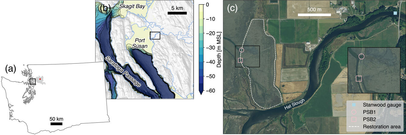
Port Susan and Stillaguamish River
Detailed Description
(a): Map showing Washington State, Port Susan region (black rectangle), Stillaguamish River watershed (gray shading), and location of SR 530 landslide (red dot). (b): Map showing study area (black rectangle) in relation to Port Susan and surrounding region. (c): NAIP orthophoto showing study area and location of the PSB1 and PSB2 breaches, the Stillaguamish River gauge at Stanwood, WA (USGS 12170300), and the restoration area. Inset shows enlargement of the breach area.