
Radiometric Stability across Landsat Missions
Detailed Description
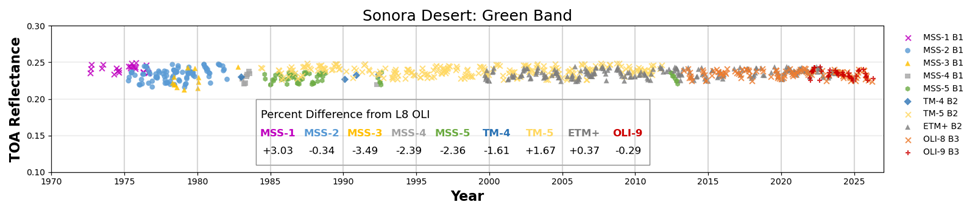
This image displays the Top of Atmosphere(TOA) Reflectance values for the Green Band from all Landsat sensors from 1972 to present over the Sonoran Desert test site. The table shows the percent difference of the sensors’ Green Band from the established baseline Landsat 8 Operational Land Imager.
The Sonoran Desert location has been used to monitor the long-term radiometric stability of Landsat and other remote sensing instruments.
Visit the Landsat Missions webpage to learn more.
Sources/Usage
Public Domain.