
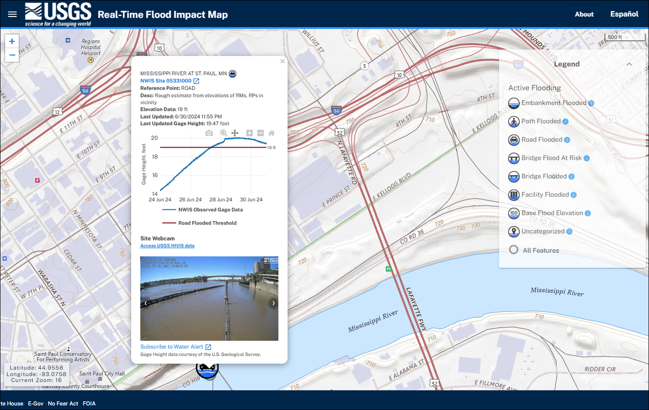
Real-Time Flood Impact Map: flooded road impact location in St. Paul, MN
Detailed Description
Clicking on a flood feature icon in the USGS Real-Time Flood Impact Map will display information about that Flood Impact Location, the current conditions at the nearby USGS streamgage, and the USGS HIVIS webcam image (if available). For example, this Flood Impact Location in St. Paul, MN displayed a flooded road icon on June 30, 2024. The presence of flooding can be confirmed by the streamgage height (blue line) rising above the surveyed road height (red line) in the hydrograph, and by the floodwaters shown in the gage’s webcam that day.
Sources/Usage
Public Domain.