
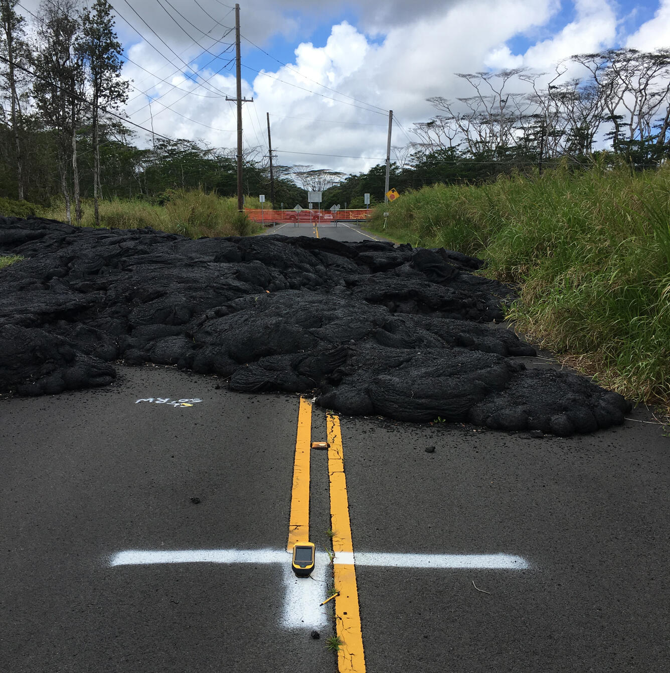
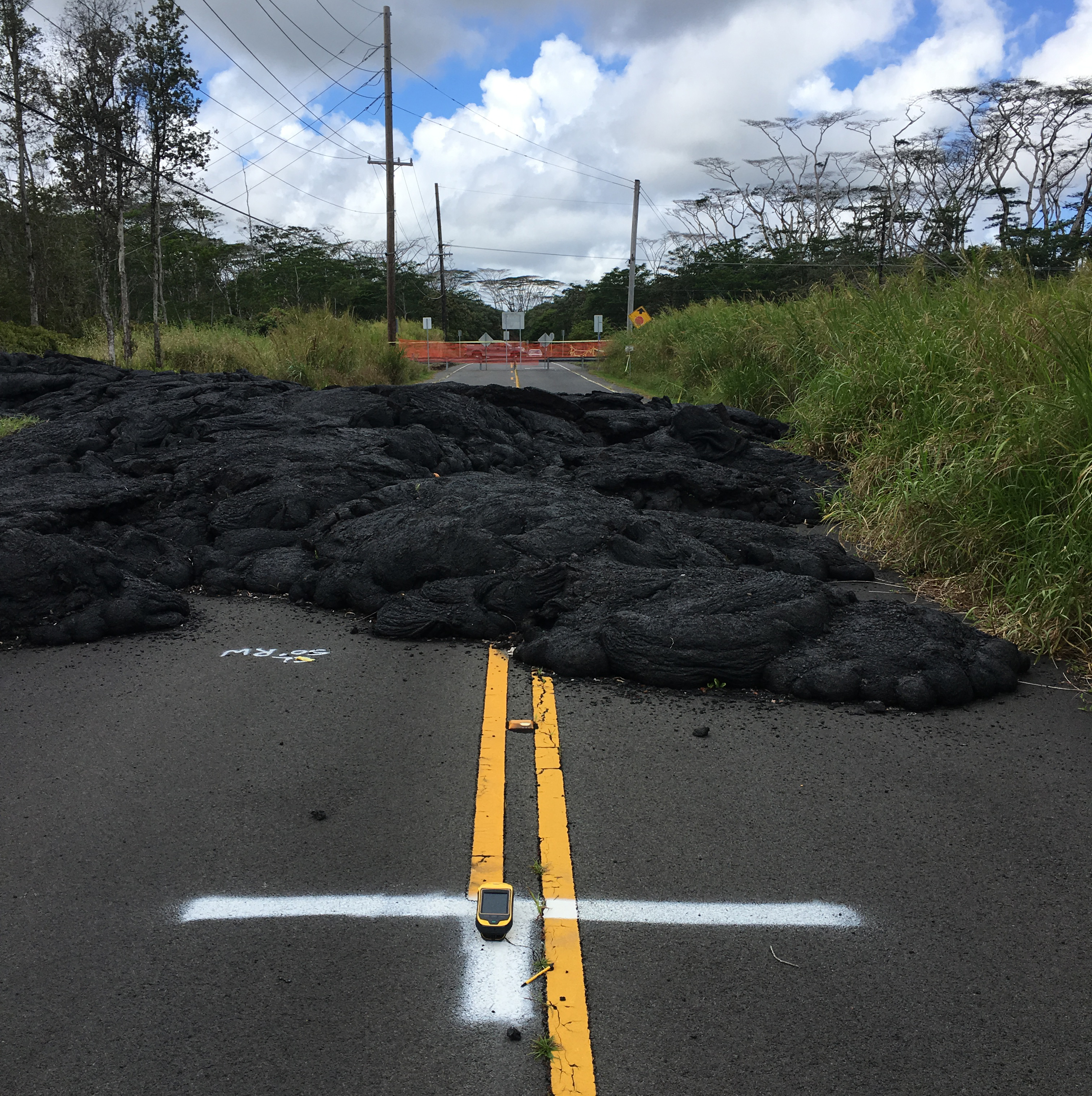
Recent ground control survey helps finalize USGS lava thickness map
Detailed Description
A high-precision GPS unit (on white "T" in foreground) records its position at a ground control point along Pohoiki Road. This marker was painted in July 2018 and is visible in numerous aerial photographs taken by USGS Hawaiian Volcano Observatory geologists throughout Kīlauea's lower East Rift Zone eruption last summer. GPS data are recorded over a period of four minutes at each location, enabling vertical precision of approximately 18 cm (7 in). USGS photo by M. Zoeller, 03/22/2019.
Sources/Usage
Public Domain.