
Red River Flood 1997

Detailed Description
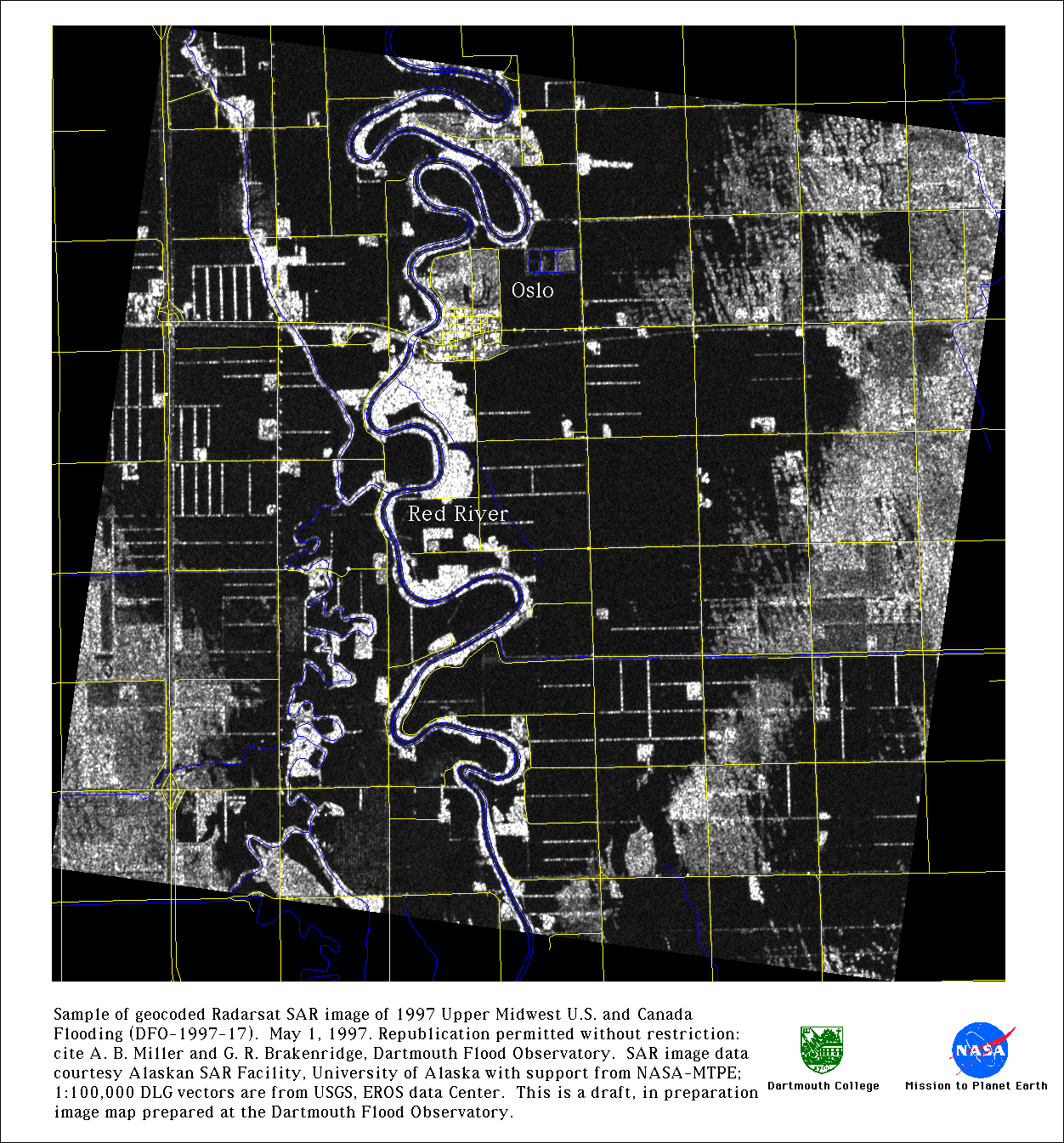
Sample of geocoded Radarsat SAR image of 1997 Upper Midwest U.S. and Canada Flooding. May 1, 1997. Republication permitted without restirction: cite A. B. Miller and G. R. Brakenridge, Dartmouth Flood Observatory. SAR image data courtesy Alaskan SAR Facility, University of Alaska with support from NASA-MTPE; 1:100,000 DLG vectors are from USGS, EROS Data Center. This is a draft, in preparation image map prepared at the Dartmouth Flood Observatory.