
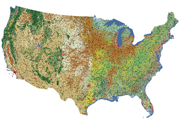
Reference And Validation Collection 1.0 sample plots

Altered Content -
All Annual NLCD products are created with deep learning AI
Detailed Description
Locations of the 8,360 plots included in the reference dataset that were used in the accuracy assessment of Annual NLCD CU 1.0 (1985 – 2023). Each plot includes primary (most likely) and alternate (but could be) land cover type calls for 1984 – 2023.
Sources/Usage
Public Domain.
Related

Reference and Validation
The Annual NLCD Reference & Validation (R&V) is designed to support the development of consistent land cover and land cover change products and data. The R&V process involves collecting reference data to validate Anderson Level II land cover classes and change products across the United States. The R&V team gathers, organizes, and refines an independent reference datasets to generate validation...
Related
Reference and Validation
The Annual NLCD Reference & Validation (R&V) is designed to support the development of consistent land cover and land cover change products and data. The R&V process involves collecting reference data to validate Anderson Level II land cover classes and change products across the United States. The R&V team gathers, organizes, and refines an independent reference datasets to generate validation...