
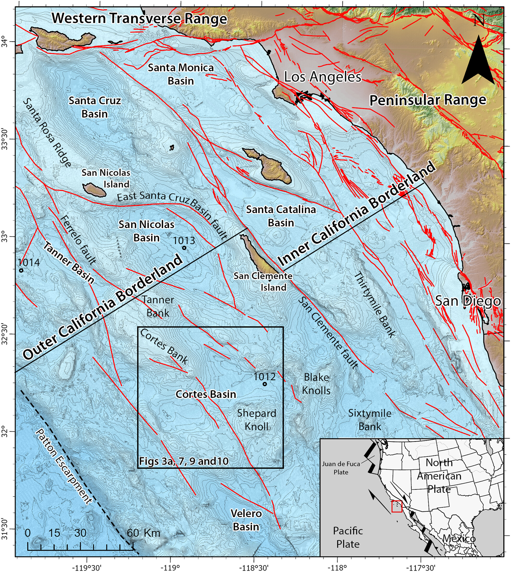
Regional bathymetric map of Southern California and California Continental Borderland

Detailed Description
Regional bathymetric map of Southern California and California Continental Borderland, from the study Interplay Between Tectonics and Submarine Mass Transport Deposits in Cortes Basin: New High-Resolution Geophysics in the Outer California Borderland.
Sources/Usage
Public Domain.