
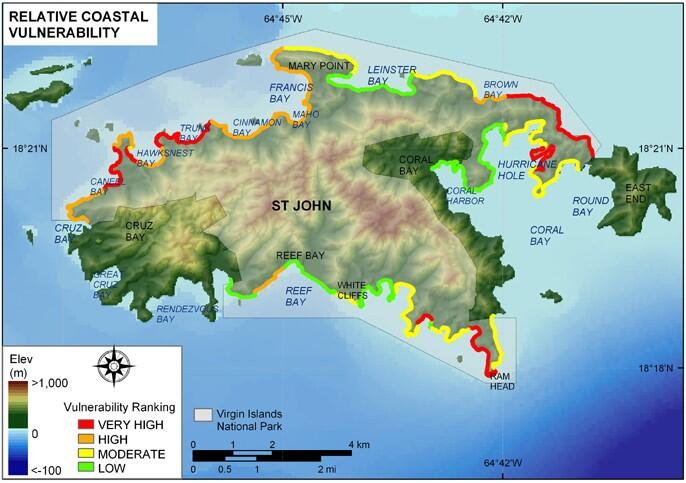
Relative Coastal Vulnerability for Virgin Islands National Park.
Detailed Description
Relative Coastal Vulnerability for Virgin Islands National Park. The colored shoreline represents the relative coastal vulnerability index (CVI) determined from the six variables. The very high vulnerability shoreline is located along sandy pocket beaches where coastal slope is low and significant wave heights are high. The low vulnerability shoreline is generally located along rock cliffs or in sheltered areas such as in Hurricane Hole.
Sources/Usage
Public Domain.