
Rice field water depth and shorebird abundance
By Western Ecological Research Center (WERC)
2023 (approx.)

Detailed Description
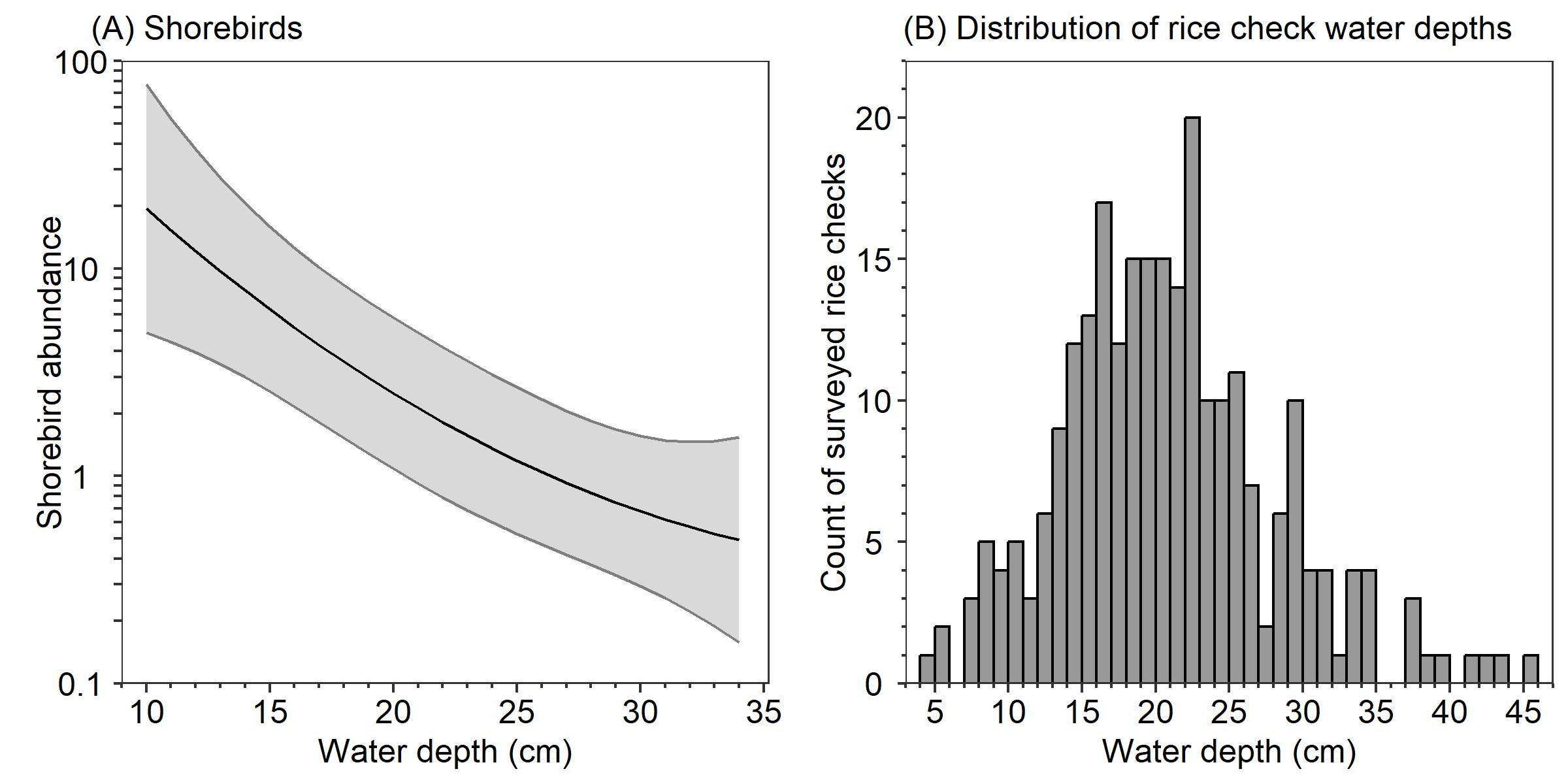
Model-averaged predictions (with 95% confidence intervals) for the abundance of (A) small and medium shorebirds, correlated with the water depth of winter-flooded rice fields in the Sacramento Valley, California. The range of depths for panel A includes the 5th to 95th quantile of observed water depths for all surveyed rice checks. Predictions were generated for the winter of 2021-2022 by holding all other variables in the model at their median or most values, except for days since flooding started, which was set at 20 days. Panel B shows the distribution of the mean water depths that were observed within all 253 rice checks that were surveyed during the winters of 2021-2022 and 2022-2023.
Sources/Usage
Public Domain.