



Rowe Creek Complex Fire, Oregon 2026
Detailed Description
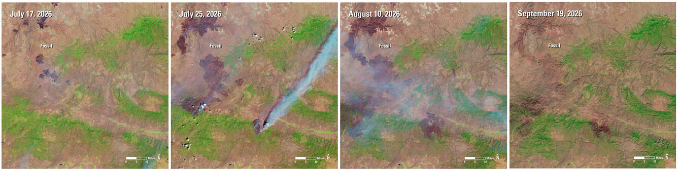
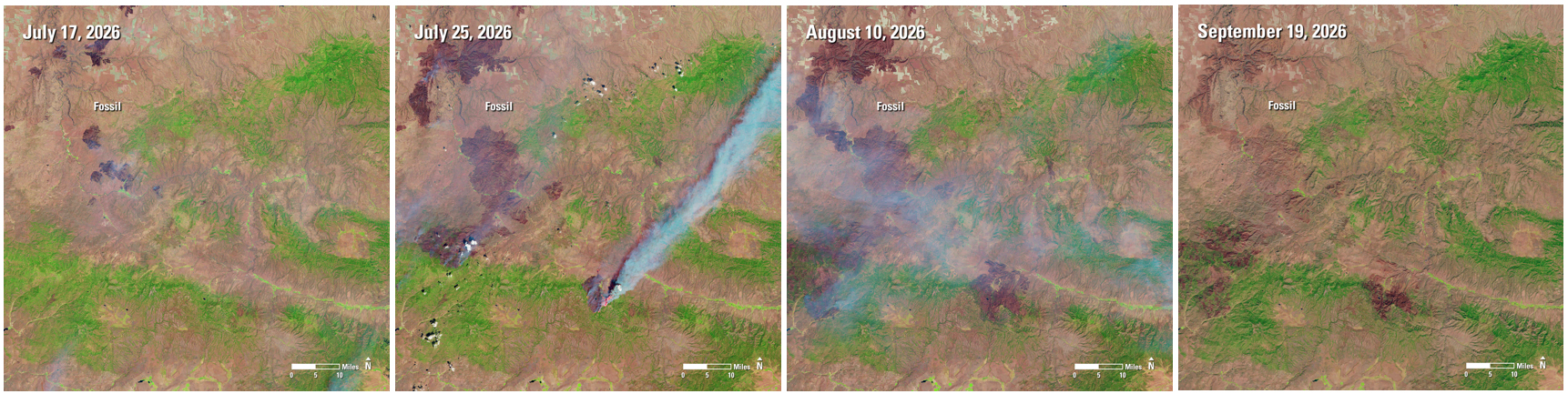
Wildfires ravaged an area in north central Oregon during the summer of 2026. The Rowe Creek Complex was a cluster of wildfires caused by lightning near Fossil, Oregon in July. The fire grew quickly across the landscape of grasslands, brush, and timber, and burned nearly 374,000 acres before it was nearly contained in late August.
Landsat images let us see the area from 438 miles above the earth. This series of Landsat 8 and Landsat 9 images shows the area during and after the fires scorched the earth.
The burn scars provide a record of the fire’s footprint that is mapped and studied. Landsat data help show where a fire burned most severely, how vegetation responds and recovers, and where the effects of fire persist. Continued observations allow land managers and researchers to track changes across the landscape.
July 17: Landsat 9
July 25: Landsat 8
August 10: Landsat 8
September 19: Landsat 9
Sources/Usage
Public Domain.