
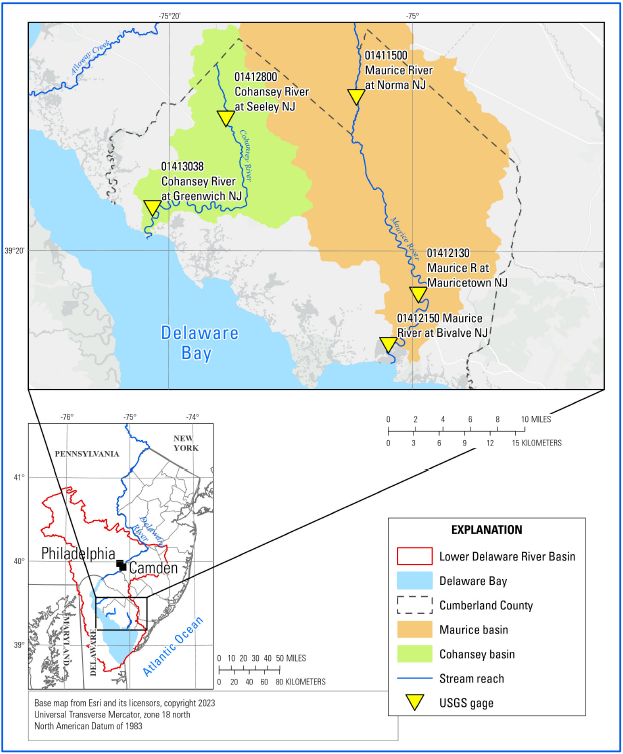
Saltwater Inundation Study Area Map

Detailed Description
Map showing the lower Delaware River basin, Cumberland County, New Jersey, and locations of U.S. Geological Survey gages along the reaches of the Maurice and Cohansey Rivers.
Sources/Usage
Public Domain.
Related

Estimating Daily Upstream Location of the Freshwater-Saltwater Interface in New Jersey
Frequently, water withdrawals for public supply are made from the freshwater reaches of rivers and streams across New Jersey. Overall, there is a lack of scientific information describing the movement of saltwater upstream into the tributaries discharging into Delaware Bay. This project is collected water-quality data along two selected tributaries in New Jersey to Delaware Bay to develop a...
Related
Estimating Daily Upstream Location of the Freshwater-Saltwater Interface in New Jersey
Frequently, water withdrawals for public supply are made from the freshwater reaches of rivers and streams across New Jersey. Overall, there is a lack of scientific information describing the movement of saltwater upstream into the tributaries discharging into Delaware Bay. This project is collected water-quality data along two selected tributaries in New Jersey to Delaware Bay to develop a...