
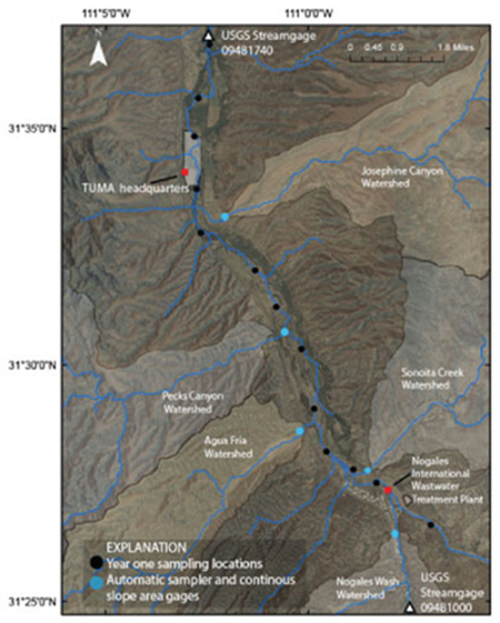
Sampling locations and major contributing watersheds.

Detailed Description
Map showing sampling locations and major contributing watersheds near Tumacacacori National Historical Park, Southern Arizona.
Sources/Usage
Public Domain.
Related

Spatial and Temporal Distribution of Bacterial Indicators and Microbial Source Tracking within Tumacácori National Historical Park and the Santa Cruz River Watershed
Elevated levels of bacteria have been measured by the USGS, National Park Service, Arizona Department of Environmental Quality (ADEQ), and other agencies, in the Upper Santa Cruz River, including within the reach at Tumacácori National Historical Park (TUMA). Indicators of pathogens in the river at TUMA are at levels that are of great concern to TUMA personnel responsible for safeguarding two of...
Related
Spatial and Temporal Distribution of Bacterial Indicators and Microbial Source Tracking within Tumacácori National Historical Park and the Santa Cruz River Watershed
Elevated levels of bacteria have been measured by the USGS, National Park Service, Arizona Department of Environmental Quality (ADEQ), and other agencies, in the Upper Santa Cruz River, including within the reach at Tumacácori National Historical Park (TUMA). Indicators of pathogens in the river at TUMA are at levels that are of great concern to TUMA personnel responsible for safeguarding two of...