
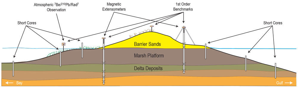
Schematic of proposed barrier island subsidence sampling and monitorin
Detailed Description
Schematic of proposed barrier island subsidence sampling and monitoring set up. Primary procedure: 1) install 1st order benchmarks to monitor surface elevation (subsidence) across barrier island; 2) collect topography and bathymetry data (including inlets at each end) to compare with archived data and elevations; 3) collect auger cores (~10 to 20 meter deep) for stratigraphy; 4) install extensometers to monitor compaction following core collection; and 5) collect short cores as proof-of-concept identifying subsidence versus erosion by comparing short-and long-lived isotopes (7Be/234Th, 210Pb/137Cs, and Rad7).
Sources/Usage
Public Domain.
Related

Subsidence and Coastal Geomorphic Change in South-Central Louisiana
New methods will investigate coastal subsidence on and around barrier islands before and after restoration.
Related
Subsidence and Coastal Geomorphic Change in South-Central Louisiana
New methods will investigate coastal subsidence on and around barrier islands before and after restoration.