
Screen shot of the Texas Land Subsidence web application

Detailed Description
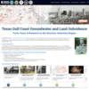
Screen shot of the Texas Gulf Coast Groundwater and Land Subsidence Program web application.
Sources/Usage
Public Domain.
Related

Texas Gulf Coast Groundwater and Land Subsidence Program
The Texas Gulf Coast Groundwater and Land Subsidence Program web application illustrates how groundwater, sediment compaction, and land-elevation change are related in the Houston-Galveston region in Texas.

Houston Area Groundwater Level and Subsidence Monitoring
In cooperation with Harris-Galveston Subsidence District, the City of Houston, Fort Bend County Subsidence District, Lone Star Groundwater Conservation District, and Brazoria County Groundwater Conservation District, the USGS Oklahoma-Texas Water Science Center Gulf Coast Program collects, processes, and interprets groundwater-level and aquifer-sediment-compaction data to understand the effects of...
Subsidence Science in Oklahoma and Texas - Overview
The USGS Oklahoma-Texas Water Science Center (OTWSC) has researched land-surface subsidence for more than 40 years. OTWSC collects and interprets groundwater level and aquifer sediment compaction data to understand the effects of groundwater withdrawal on land surface subsidence.
Related
Texas Gulf Coast Groundwater and Land Subsidence Program
The Texas Gulf Coast Groundwater and Land Subsidence Program web application illustrates how groundwater, sediment compaction, and land-elevation change are related in the Houston-Galveston region in Texas.
Houston Area Groundwater Level and Subsidence Monitoring
In cooperation with Harris-Galveston Subsidence District, the City of Houston, Fort Bend County Subsidence District, Lone Star Groundwater Conservation District, and Brazoria County Groundwater Conservation District, the USGS Oklahoma-Texas Water Science Center Gulf Coast Program collects, processes, and interprets groundwater-level and aquifer-sediment-compaction data to understand the effects of...
Subsidence Science in Oklahoma and Texas - Overview
The USGS Oklahoma-Texas Water Science Center (OTWSC) has researched land-surface subsidence for more than 40 years. OTWSC collects and interprets groundwater level and aquifer sediment compaction data to understand the effects of groundwater withdrawal on land surface subsidence.