



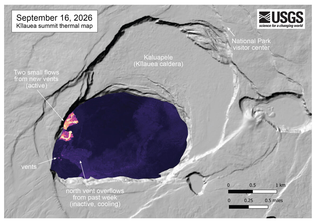
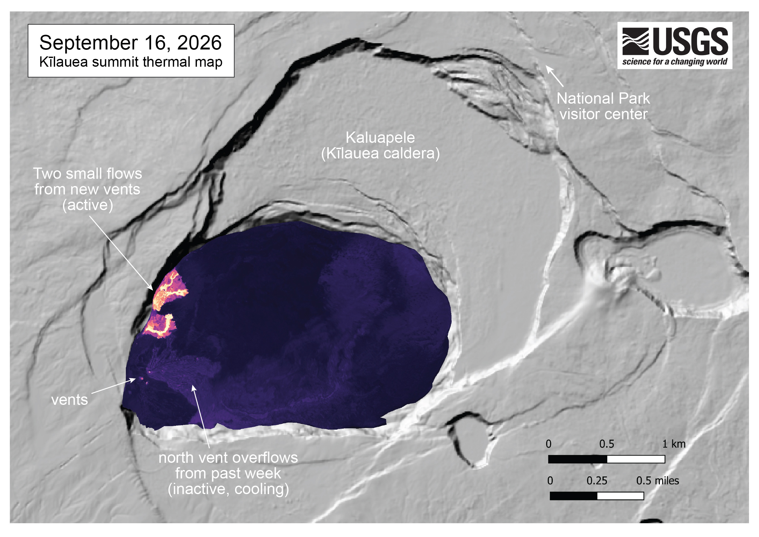
September 16, 2026 — Thermal map showing recent lava flows in Halemaʻumaʻu, Kīlauea summit
Detailed Description
This thermal map of the summit of Kīlauea was constructed from images collected during a morning overflight on September 16, 2026. The map shows two small but active flows in the northwest portion of Halema‘uma‘u crater, erupting from new vents that opened in the past two days. The main vent complex (north, south, and west vents) remained active and each had active lava within their vent openings - these vents show as three tiny hotspots in the thermal map. Over the past week, numerous overflows have erupted from the north vent, and these flows are inactive, and show as slightly warm in the thermal map.
Sources/Usage
Public Domain.