
September 2025—Topography and bathymetry of the Manuʻa Islands, American Samoa
Detailed Description
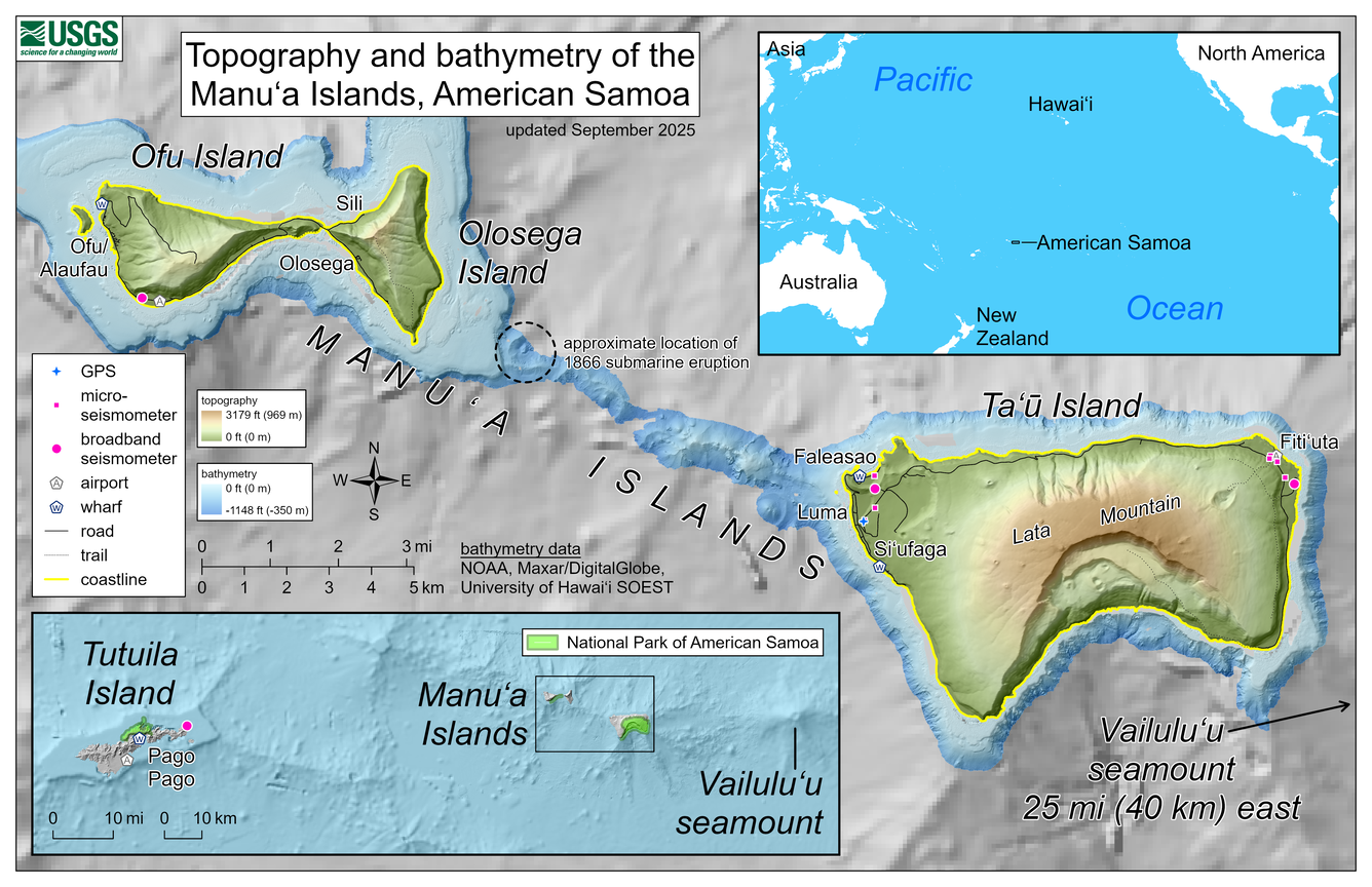
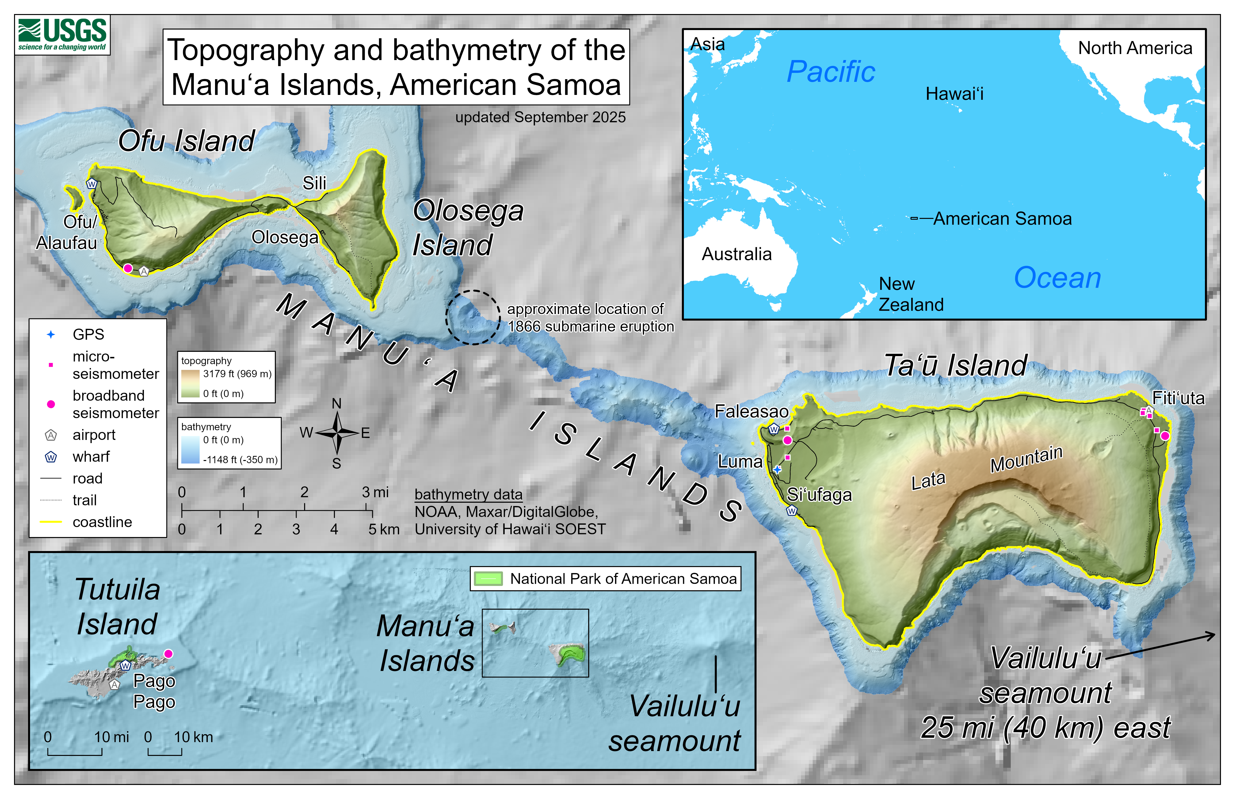
This reference map depicts the volcanoes of the Manuʻa Islands, American Samoa, which are monitored by the USGS Hawaiian Volcano Observatory. Marked on the map are the locations of Hawaiian Volcano Observatory GPS and seismometers in the islands; the locations have been updated for network reconfigurations that occurred during site visits in early September 2025.
The topography and bathymetry are colored to respectively indicate elevations above sea level (up to 3,179 feet or 969 meters, the top of Lata Mountain) and depths below sea level (only down to -1,148 feet or -350 meters). The bathymetry data are courtesy of the National Oceanic and Atmospheric Administration (NOAA), Maxar/DigitalGlobe, and the University of Hawaiʻi School of Ocean & Earth Science & Technology (SOEST), with coarser resolution at greater depths. A shallow submarine ridge extends to the northwest from Taʻū Island towards Olosega Island; it was along this ridge that a submarine eruption occurred in 1866.
Sources/Usage
Public Domain.