
Photo & Video Chronology – August 28-September 11, 2025 – Field work and community engagement in American Samoa
HVO scientists traveled to American Samoa for critical network maintenance, meetings with partners, and community outreach from August 28-September 11, 2025.
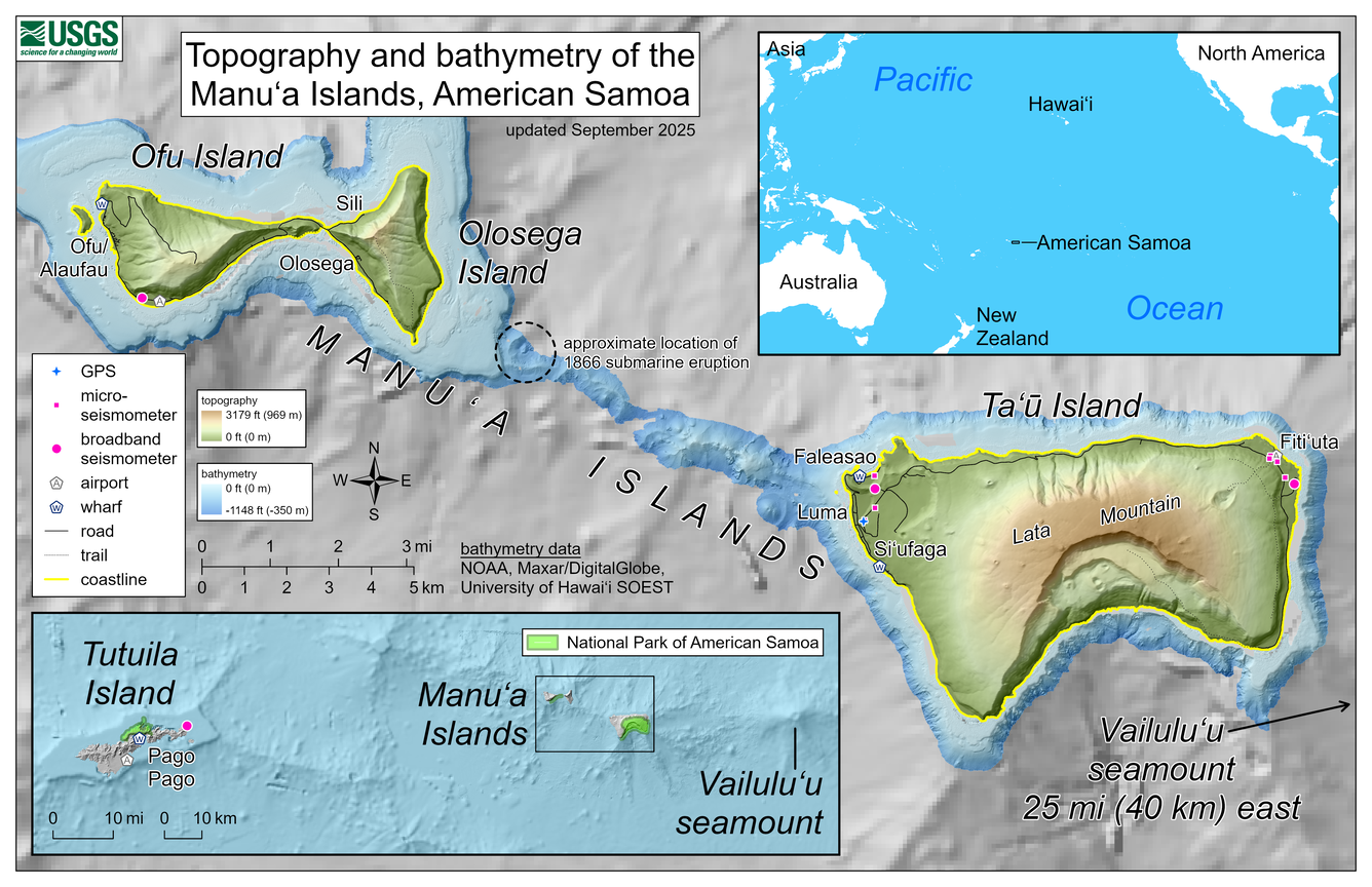
This reference map depicts the volcanoes of the Manuʻa Islands, American Samoa, which are monitored by the USGS Hawaiian Volcano Observatory. Marked on the map are the locations of Hawaiian Volcano Observatory GPS and seismometers in the islands; the locations have been updated for network reconfigurations that occurred during site visits in early September 2025.
The topography and bathymetry are colored to respectively indicate elevations above sea level (up to 3,179 feet or 969 meters, the top of Lata Mountain) and depths below sea level (only down to -1,148 feet or -350 meters). The bathymetry data are courtesy of the National Oceanic and Atmospheric Administration (NOAA), Maxar/DigitalGlobe, and the University of Hawaiʻi School of Ocean & Earth Science & Technology (SOEST), with coarser resolution at greater depths. A shallow submarine ridge extends to the northwest from Taʻū Island towards Olosega Island; it was along this ridge that a submarine eruption occurred in 1866.

Broadband seismometer site on eastern Taʻū, American Samoa, before (inset) and after a work party cleared rapidly growing vegetation which had covered the solar panels along with the boulders to the right of the main photo. Due to lack of power from the solar panels being unable to charge during the day, the station was offline for many months. To help with image comparison, the same tree is circled in both photos, and the box with the question mark inside on the inset is the approximate location of the solar panels. The prominent tree to the left in the inset was cut down; the stump is visible in the main photo.
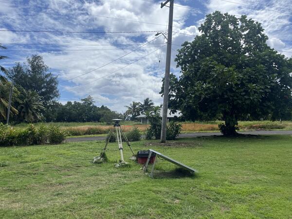
Photo of the USGS Global Positioning System (GPS) monitoring station on western Ta‘ū Island in the Manuʻa Islands of American Samoa. The station consists of a GPS unit, which can measure very slight movements of the ground, placed on a tripod that is leveled and centered over a benchmark. Together with a network of seismic stations (recording earthquake activity), this GPS station is used by the USGS Hawaiian Volcano Observatory to monitor the volcanoes of American Samoa. USGS photo by N. Deligne.
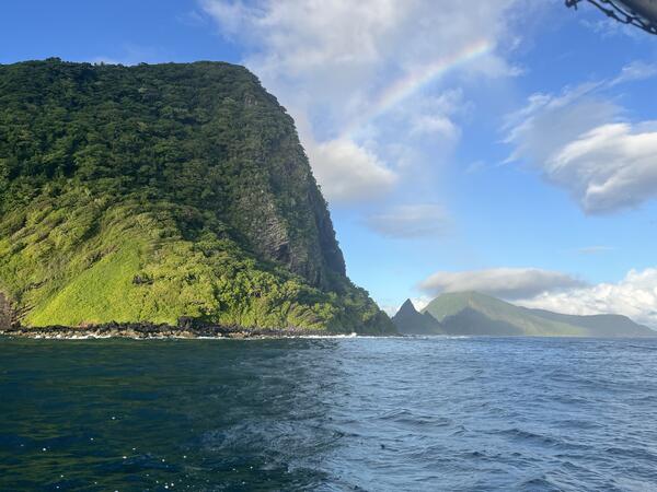
This photo, taken from a boat, shows Olosega Island on the left, and Ofu Island further away on the right, in the Manuʻs Islands of American Samoa. These islands, connected by a one-lane bridge (out of sight), are the top of Ofu-Olosega volcano. USGS photo by N. Deligne.
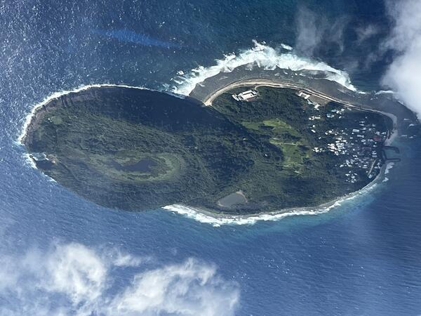
USGS Hawaiian Volcano Observatory scientists took this photo of Aunu‘u Island while on a flight from Tutuila to Ofu Island in American Samoa on September 2, 2025. The view is from the south looking north. Aunu‘u Island is a tuff cone less than 1 mile southeast of Tutuila Island and is considered part of Tutuila volcano. A tuff cone can form when magma and water interact at shallow depths, causing localized explosions. While scientists do not know when the eruption that formed Aunu‘u Island occurred, the lack of erosional features suggests it erupted in the Holocene (within the last 12,000 years). The Village of Aunu‘u is located on the western side of the island, and is only accessible by boat. USGS photo by N. Deligne.
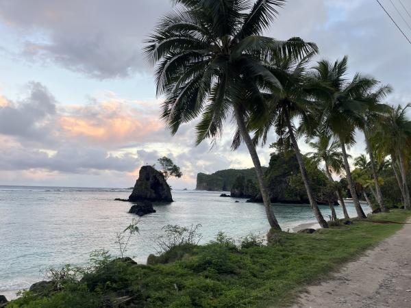
This photo shows part of the western Ofu coastline and several small islands west of Ofu Island, American Samoa. These islands are considered part of Ofu-Olosega volcano in the Manuʻa Islands. The island in the middle on the skyline is officially known as Nuʻutele Island, although it may have other names locally; it is an eroded tuff cone formed when magma and water interact at shallow depths, causing localized explosions. USGS photo by N. Deligne.
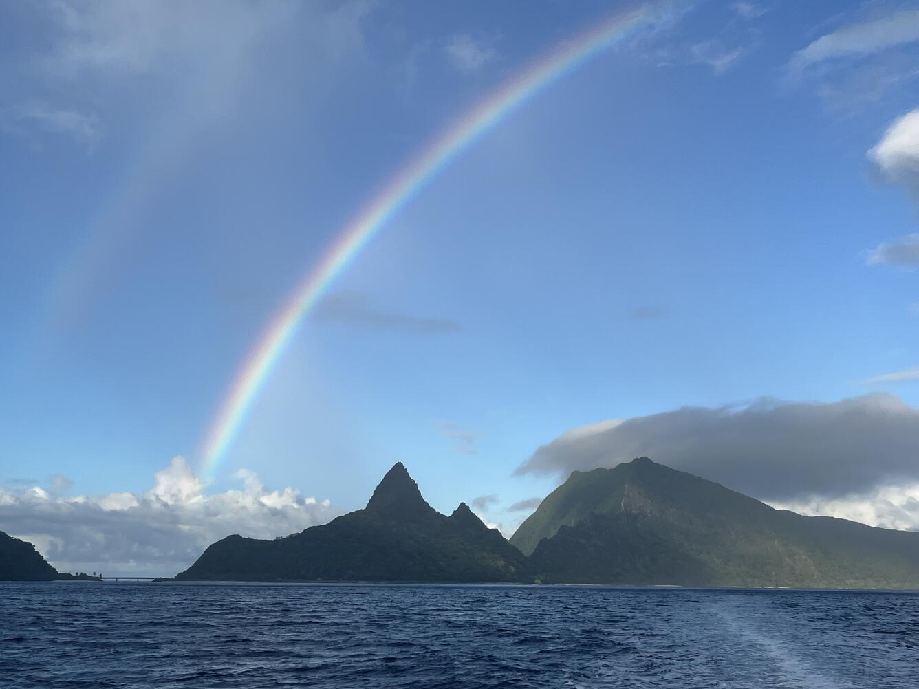
USGS Hawaiian Volcano Observatory scientists and NOAA National Weather Service Weather Service Office Pago Pago meteorologists travelled by boat between the Manuʻa Islands, American Samoa, during an outreach and monitoring network maintenance trip in early September 2025. This view is from the boat looking south towards the north side of Ofu Island. The Asaga Bridge connecting Ofu Isand (right) and Olosega Island (left) is visible on the left. Ofu-Olosega volcano last erupted in 1866 C.E. with an eruption about 2 miles (3 kilometers) southwest of Olosega Island. USGS photo by N. Deligne.