
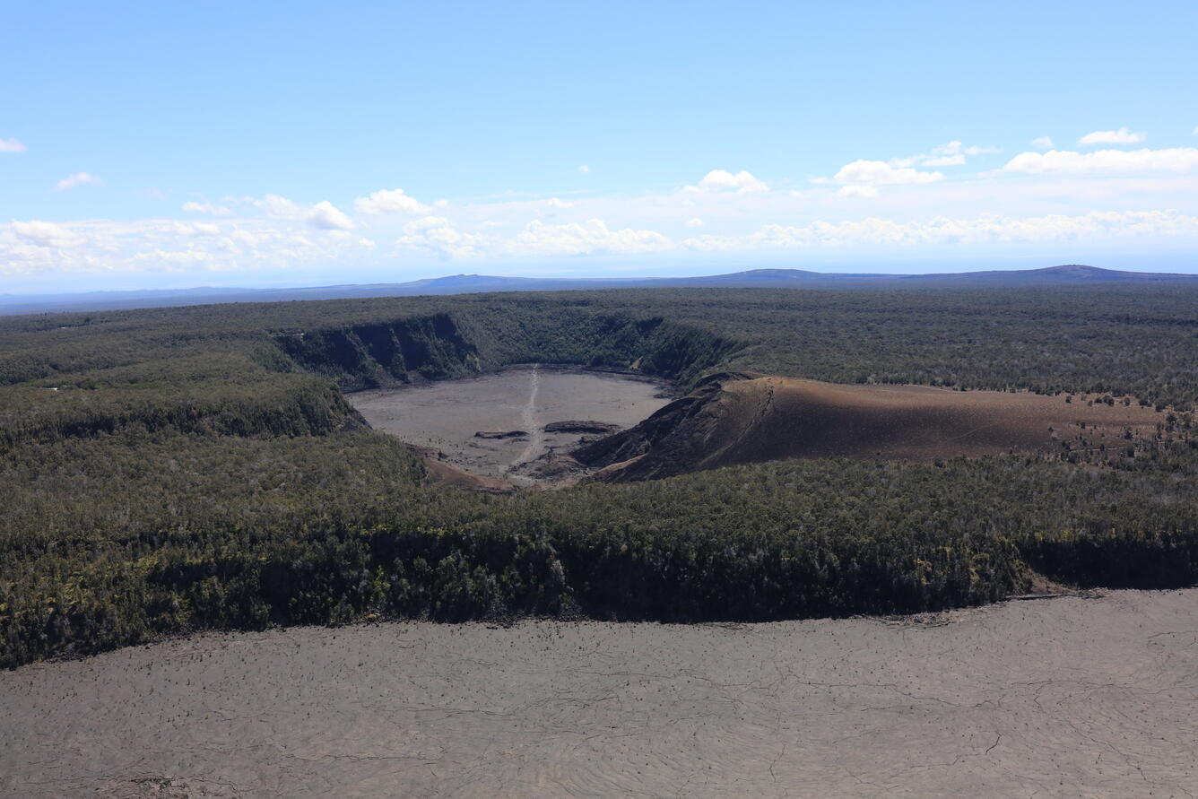
September 24, 2025 — Aerial view of Kīlauea Iki, Pu‘u Pua‘i, Pu‘u‘ō‘ō, and Kānenuiohamo, and Maunaulu
Detailed Description
This aerial view of Kīlauea Iki (center crater with lava covering the floor) and Pu‘u Pua‘i (brown hill to its right) was taken during a USGS Hawaiian Volcano Observatory monitoring overflight of Kīlauea summit on September 24. On the horizon from left to right are, Pu‘u‘ō‘ō (center), Kānenuiohamo (right of center), and Maunaulu (right). Pu‘u Pua‘i formed during the 1959 Kīlauea Iki eruption, and is comprised of tephra deposits from lava fountains similar to those that have occurred during the 2024-2025 summit eruption at Kīlauea. However, the 1959 Kīlauea Iki "only" had 17 episodes, while the ongoing eruption is at 33 and counting. Pu‘u‘ō‘ō had 44 high lava fountaining episodes from 1983 to 1986 (the eruption continued through to 2018), and Maunaulu had 12 lava fountaining episodes in 1969 (the eruption continued through to 1974). Kānenuiohamo likely also had lava fountains, but no contemporaneous written records exist of its eruption, as it erupted several hundred years ago. USGS photo by N. Deligne.
Sources/Usage
Public Domain.