
Photo & Video Chronology — September 24, 2025 — Kīlauea
Episode 33 of the ongoing Halemaʻumaʻu eruption started around 3:11 a.m. HST on September 19, 2025 and ended at 12:08 pm HST September 19. On September 24, 2025 HVO scientists conducted field work to observe changes and collect samples of the new lava.
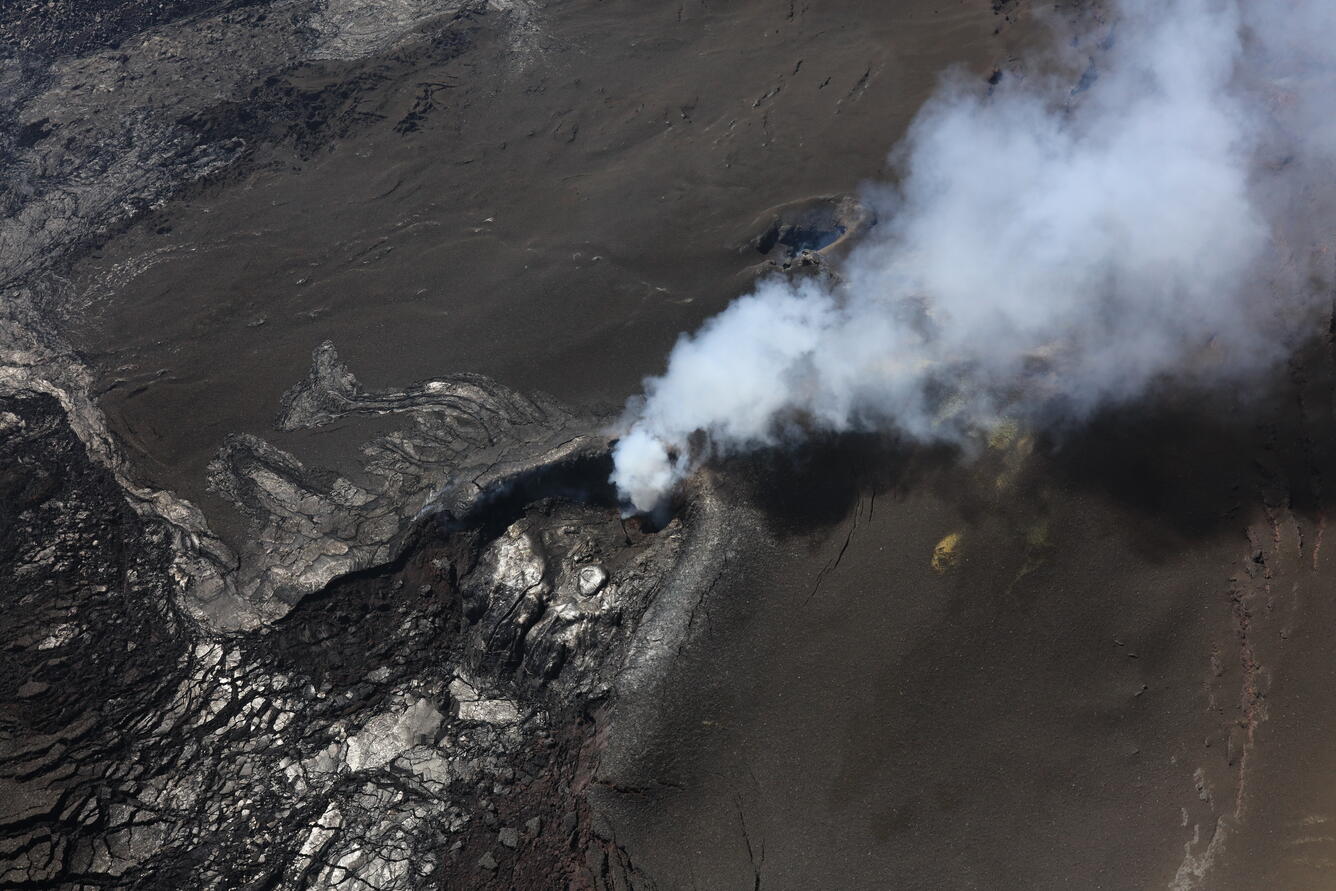
USGS Hawaiian Volcano Observatory scientists took this oblique angle view of north (center) and south vents (to the right and closer to top of photo) during a Kīlauea summit monitoring overflight on September 24. The brown sand-like material that covers the right and top parts of the photo are tephra erupted during episode 33. South vent was only active towards the beginning of the episode 33, and so north vent tephra from the later portion of episode 33 covers the lava flow from south vent. No lava was seen at the bottom of either vent. USGS photo by N. Deligne.
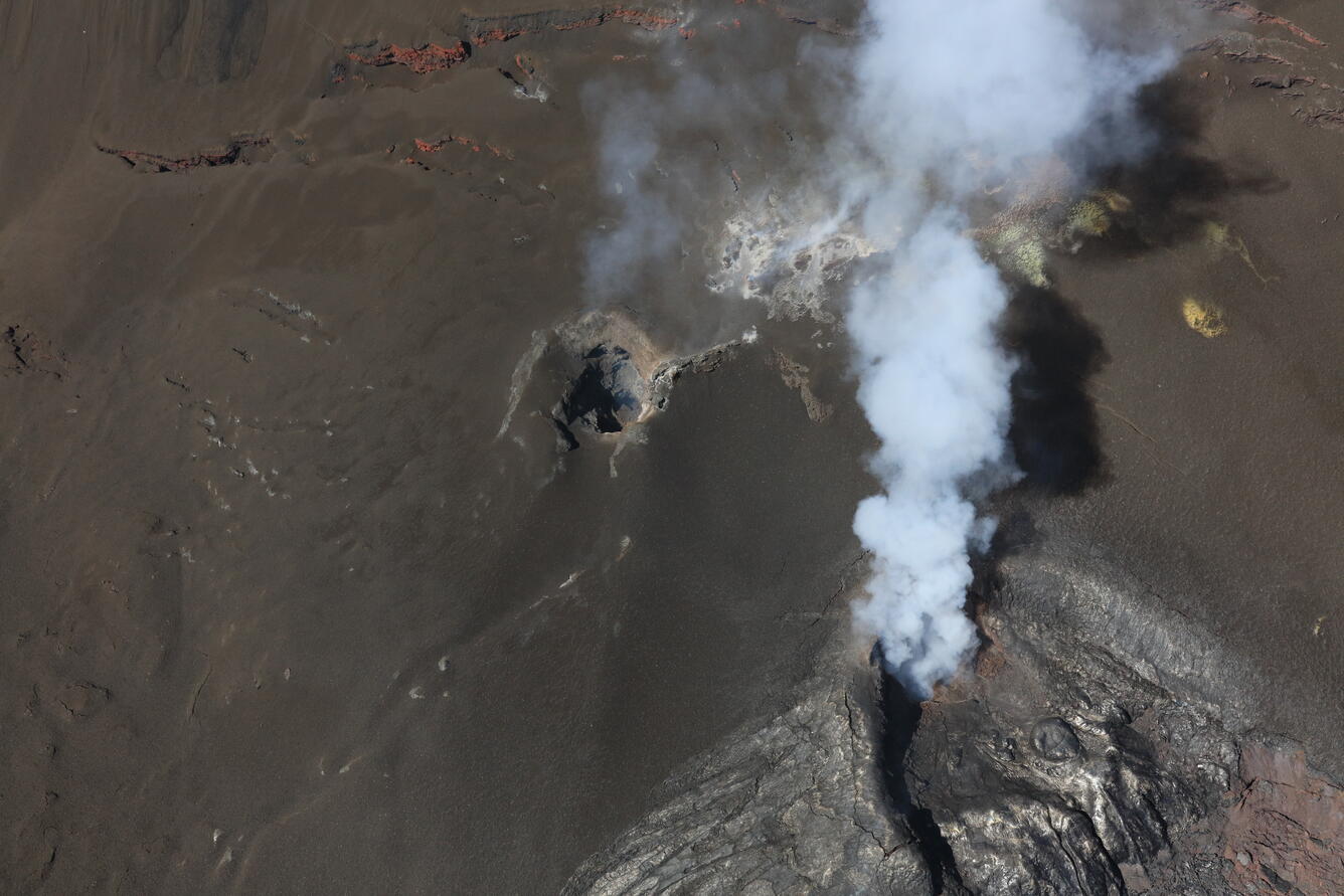
USGS Hawaiian Volcano Observatory scientists did not see any lava at the bottom of north (bottom right) or south (center) vents during a Kīlauea summit monitoring overflight on September 24. This photo shows the western wall of Halema‘uma‘u, and much of the slope is covered in brown tephra erupted during episode 33 on September 19. USGS photo by N. Deligne.
On September 24, 2025, USGS Hawaiian Volcano Observatory field crews collected samples from a cooled 'a'ā lava flow erupted during episode 33 (left half of photo in foreground) at Kīlauea volcano. This was part of a morning monitoring helicopter overflight of Kīlauea summit. The sample will be analyzed in the lab to track changes in the chemistry of erupted material and help scientists understand the processes driving the 2024-2025 episodic eruption. USGS photo by I. Johanson.
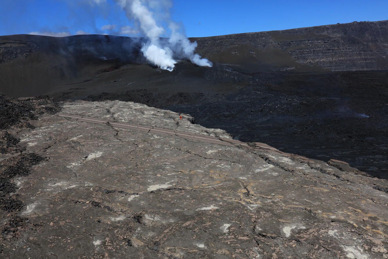
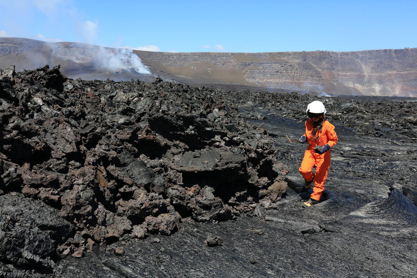
On September 24, 2025, a USGS Hawaiian Volcano Observatory scientist serviced a monitoring station at Kīlauea volcano. This site is only accessible by helicopter due to the 2018 summit caldera collapse—the road in the photo is an isolated portion of the old Crater Rim Drive, over 100 feet below the current crater rim. North (right) and south (left) vents are degassing in the background. USGS photo by N. Deligne.
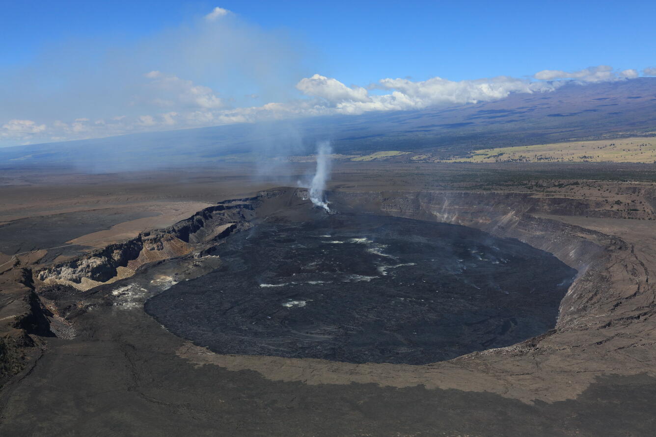
The USGS Hawaiian Volcano Observatory's helicopter overflight on September 24 provided aerial views of Kaluapele (Kīlauea caldera) from the east looking west. The vents of the eruption that started on December 23, 2024 are degassing on the western side of Halema‘uma‘u crater. Mauna Loa can be seen in the background. USGS photo by N. Deligne.
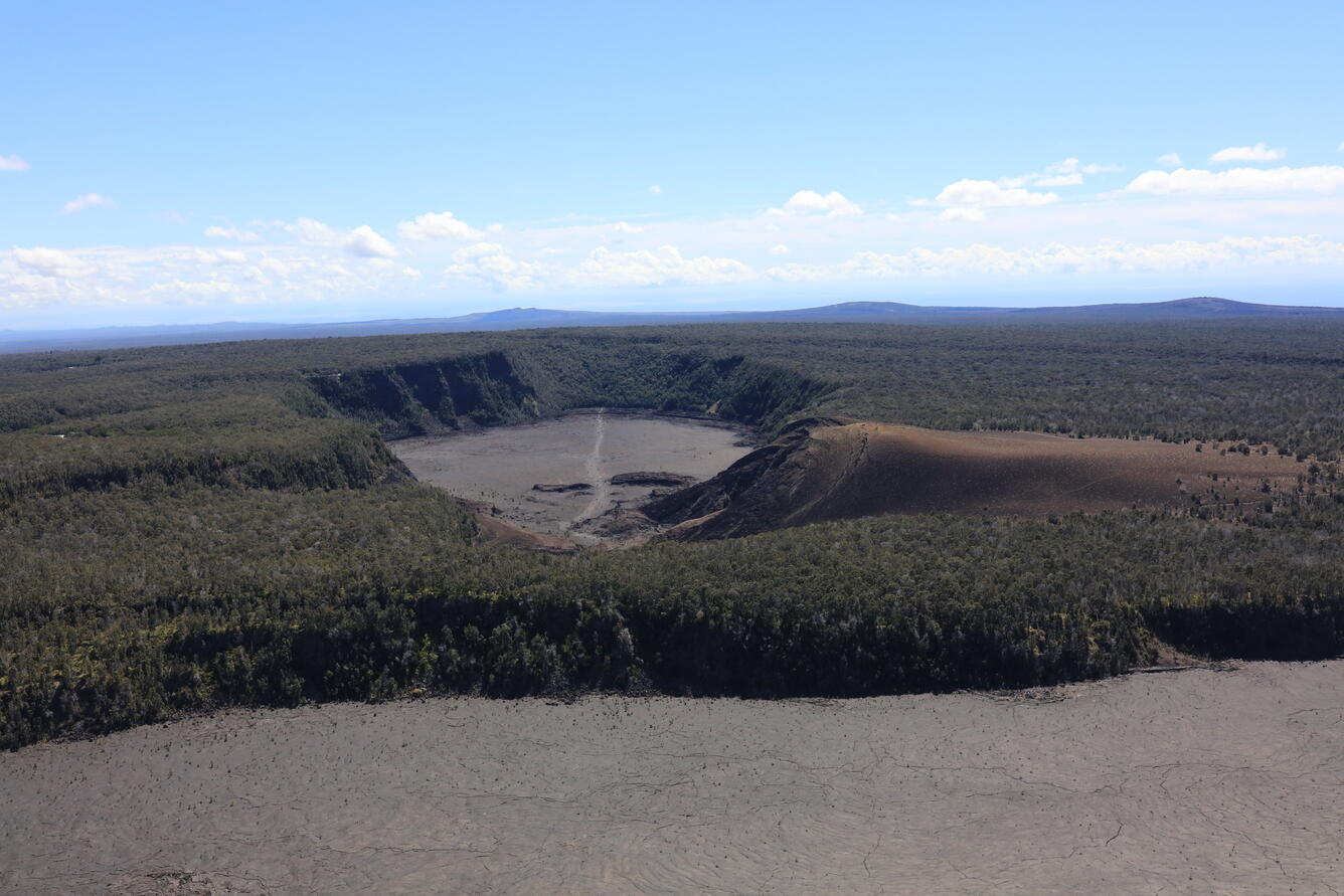
This aerial view of Kīlauea Iki (center crater with lava covering the floor) and Pu‘u Pua‘i (brown hill to its right) was taken during a USGS Hawaiian Volcano Observatory monitoring overflight of Kīlauea summit on September 24. On the horizon from left to right are, Pu‘u‘ō‘ō (center), Kānenuiohamo (right of center), and Maunaulu (right). Pu‘u Pua‘i formed during the 1959 Kīlauea Iki eruption, and is comprised of tephra deposits from lava fountains similar to those that have occurred during the 2024-2025 summit eruption at Kīlauea. However, the 1959 Kīlauea Iki "only" had 17 episodes, while the ongoing eruption is at 33 and counting. Pu‘u‘ō‘ō had 44 high lava fountaining episodes from 1983 to 1986 (the eruption continued through to 2018), and Maunaulu had 12 lava fountaining episodes in 1969 (the eruption continued through to 1974). Kānenuiohamo likely also had lava fountains, but no contemporaneous written records exist of its eruption, as it erupted several hundred years ago. USGS photo by N. Deligne.

This thermal map shows the temperature distribution on the crater floor at the summit of Kīlauea. The ongoing eruption has covered the crater floor in successive layers of new lava flows. This thermal map shows that the flows that erupted during episode 33 (September 19) remain warm, and are visible along the north and south margins of the crater. A large ponded area of lava in the eastern crater is from lava erupted during earlier episodes. USGS thermal map by M. Patrick.