
September 24, 2025— Kīlauea thermal map

Detailed Description
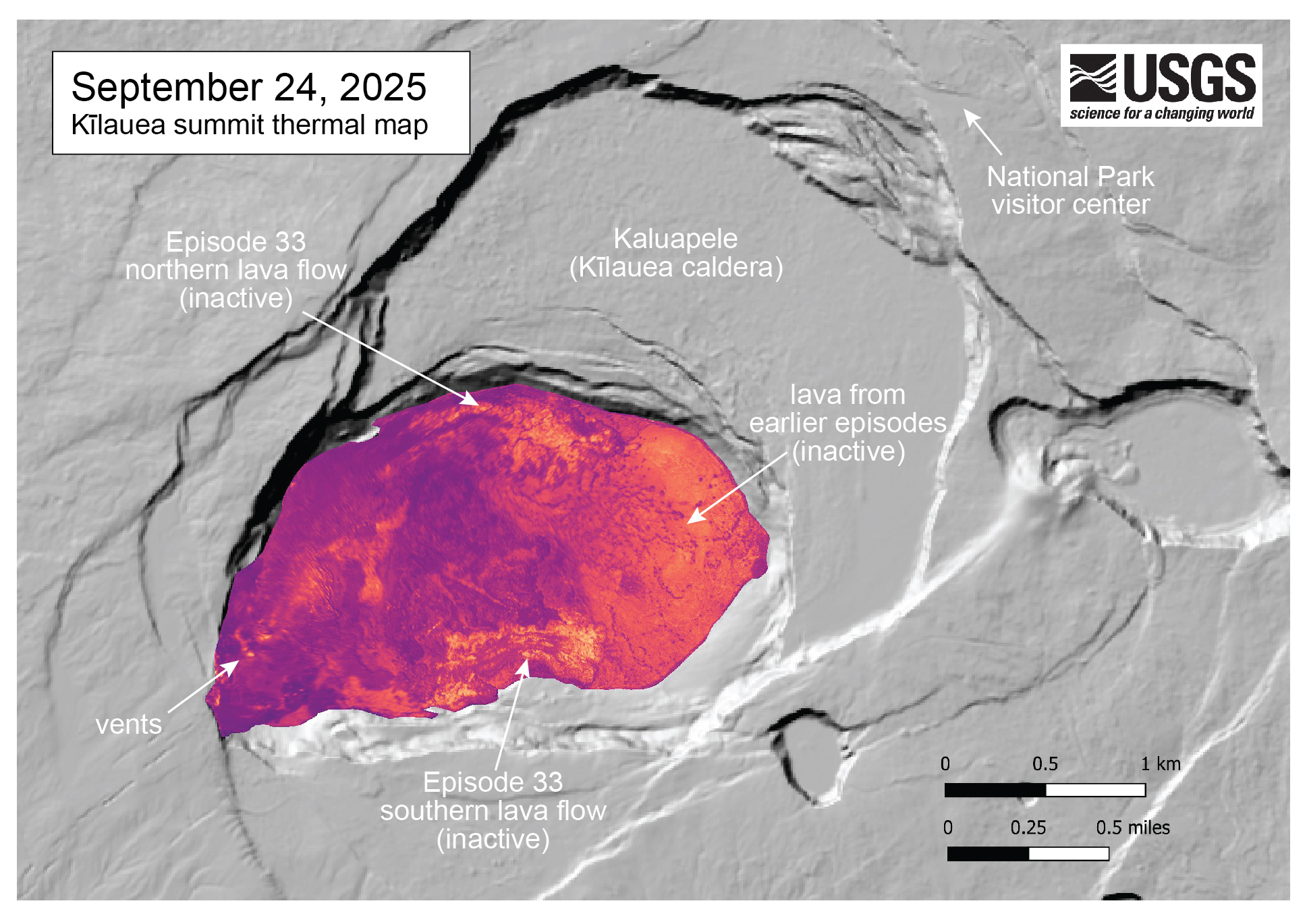
This thermal map shows the temperature distribution on the crater floor at the summit of Kīlauea. The ongoing eruption has covered the crater floor in successive layers of new lava flows. This thermal map shows that the flows that erupted during episode 33 (September 19) remain warm, and are visible along the north and south margins of the crater. A large ponded area of lava in the eastern crater is from lava erupted during earlier episodes. USGS thermal map by M. Patrick.
Sources/Usage
Public Domain.