



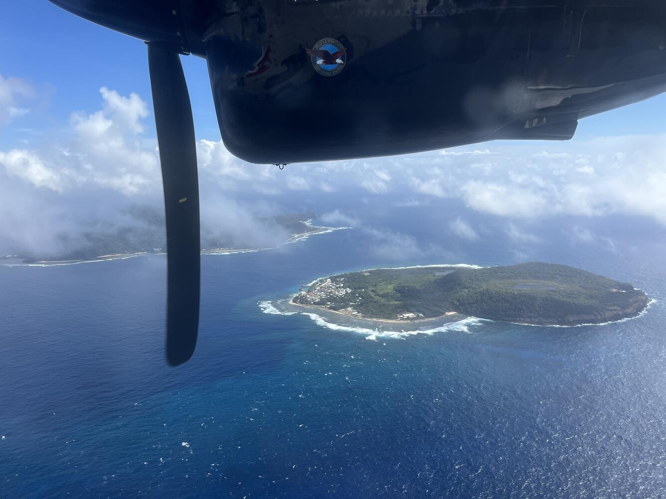
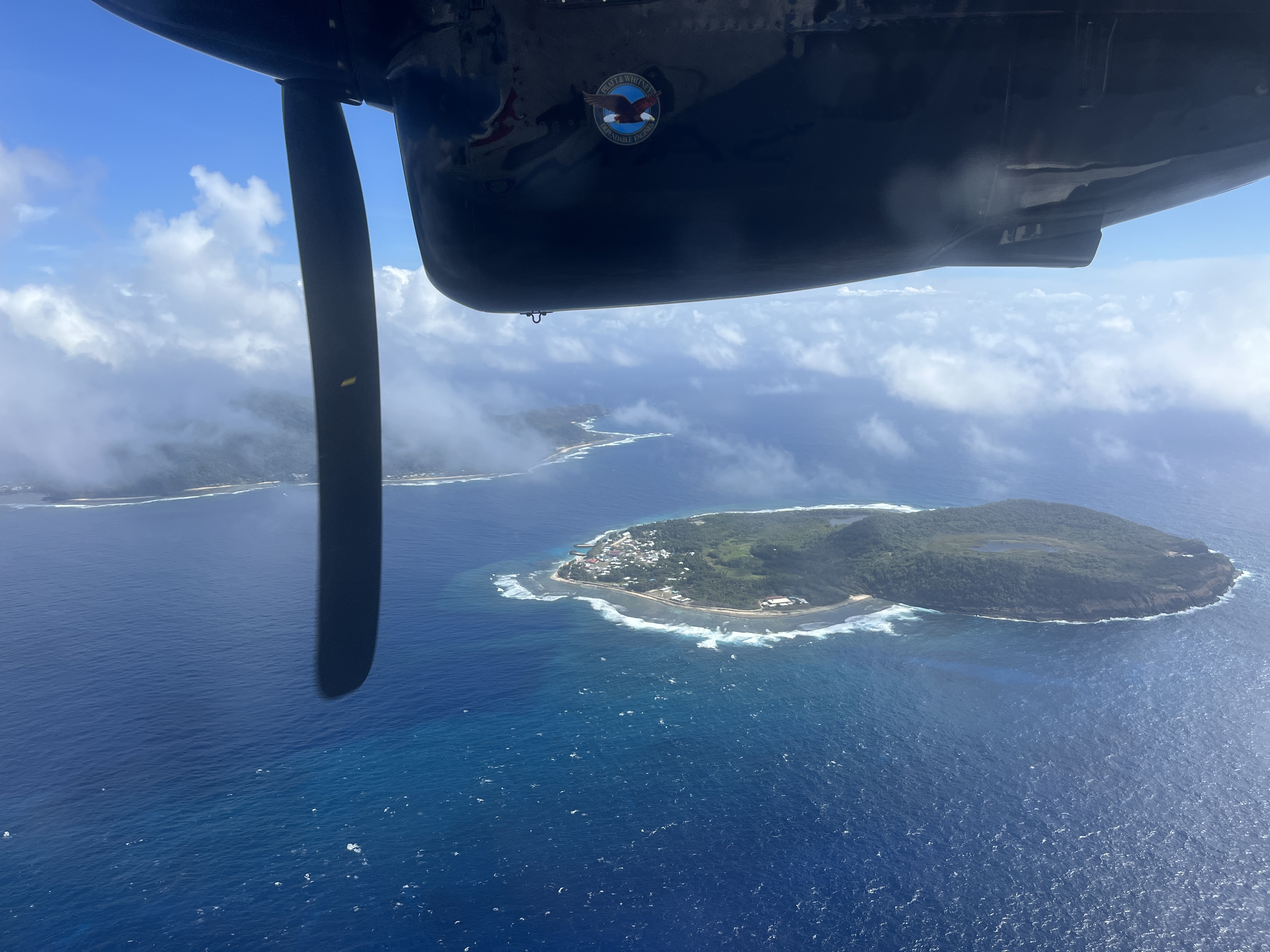
September 9, 2026 — Aerial view of Aunu‘u Island, American Samoa
Detailed Description
This photo, taken from an airplane, shows Aunu‘u Island from the south looking north; Tutuila Island is visible on the left. Aunu‘u Island is a tuff cone less than 1 mile southeast of Tutuila Island and is considered part of Tutuila volcano. A tuff cone can form when magma and water interact at shallow depths, causing localized explosions. While scientists do not know when the eruption that formed Aunu‘u Island occurred, the lack of erosional features suggests it erupted in the Holocene (within the last 12,000 years). The Village of Aunu‘u is located on the western (left) side of the island, and is only accessible by boat. USGS photo by N. Deligne.
Sources/Usage
Public Domain.