



Photo & Video Chronology — Fieldwork in American Samoa
By Hawaiian Volcano Observatory
September 14, 2026
From August 26–September 10, USGS–Hawaiian Volcano Observatory scientists were in American Samoa to conduct monitoring network maintenance and outreach.
Media
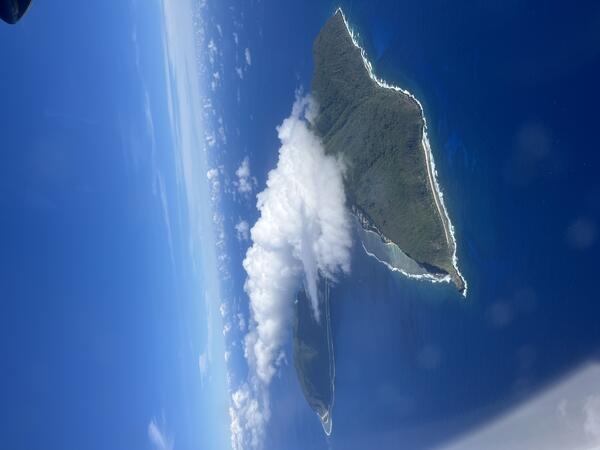
This photo, taken from an airplane, shows Ofu-Olosega from the southeast looking northwest. Olosega Island is in the right foreground, while Ofu Island is in the middle left background. Ocean waves are breaking at some distance from shore where there is a coral reef. According to the 2020 US Census, less than 300 people live on Ofu-Olosega. USGS photo by N. Deligne.
Sources/Usage: Public Domain. View Media Details
Media
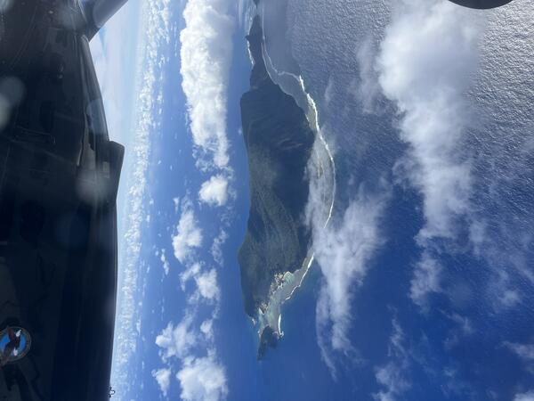
This photo, taken from an airplane, shows Ofu Island from the south looking north. Nuʻutele Island is visible to the left (west) of Ofu Island. The tallest point of Ofu Island is the peak of Tumutumu Mountain at 1,611 feet (491 meters). The westernmost edge of Olosega Island is visible to the right of Ofu Island; the two islands are connected by the Asaga bridge. USGS photo by N. Deligne.
Sources/Usage: Public Domain. View Media Details
Media
Sources/Usage: Public Domain. View Media Details
Media
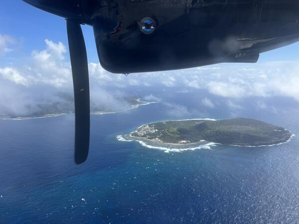
This photo, taken from an airplane, shows Aunu‘u Island from the south looking north; Tutuila Island is visible on the left. Aunu‘u Island is a tuff cone less than 1 mile southeast of Tutuila Island and is considered part of Tutuila volcano. A tuff cone can form when magma and water interact at shallow depths, causing localized explosions. While scientists do not know when the eruption that formed Aunu‘u Island occurred, the lack of erosional features suggests it erupted in the Holocene (within the last 12,000 years). The Village of Aunu‘u is located on the western (left) side of the island, and is only accessible by boat. USGS photo by N. Deligne.
Sources/Usage: Public Domain. View Media Details
Media
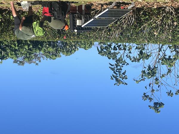
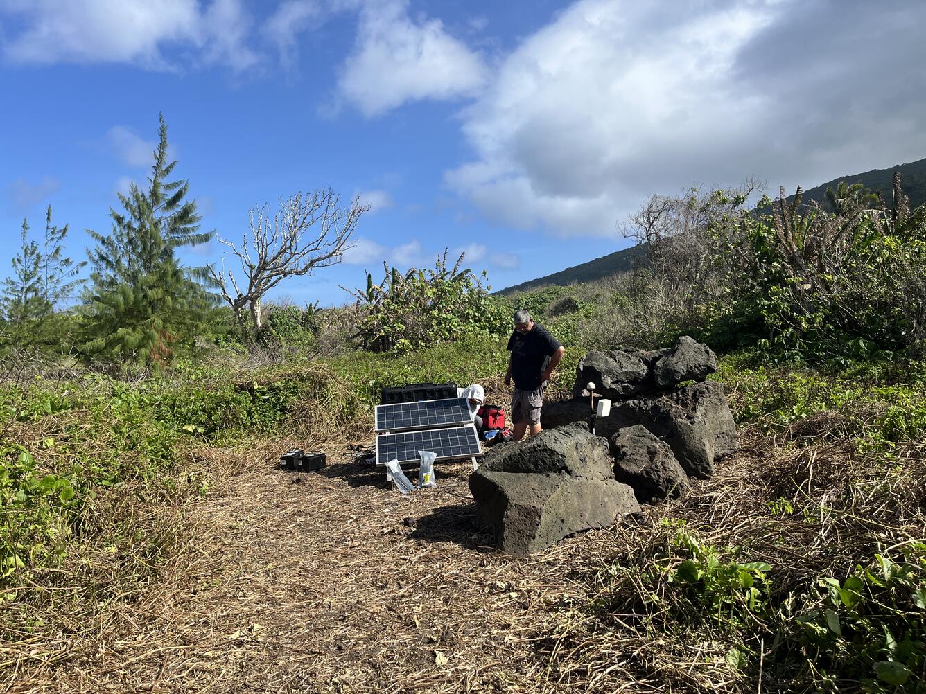
Two USGS scientists service a seismic station on Tutuila island in American Samoa. The Hawaiian Volcano Observatory uses this site and three others to monitor volcanic activity in American Samoa. These stations are also used by the NOAA Pacific Tsunami Warning Center and the USGS National Earthquake Information Center. USGS photo by N. Deligne.
Sources/Usage: Public Domain. View Media Details
Media
Sources/Usage: Public Domain. View Media Details
Media
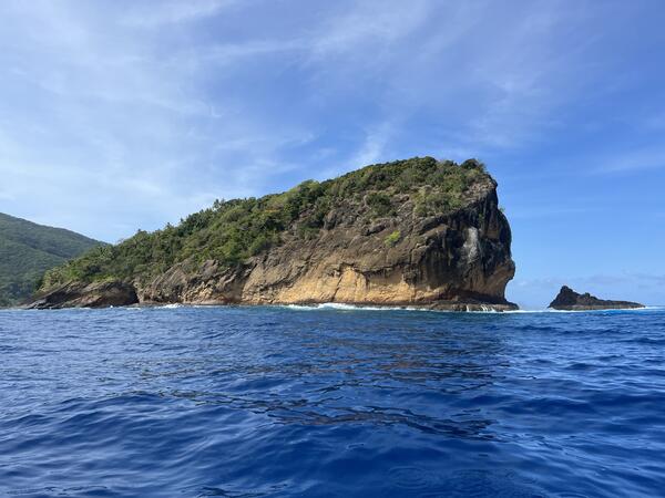
This photo, taken from a boat, shows the northwest side of Nuʻutele Island, off the west coast of Ofu Island in the Manuʻa Islands, American Samoa. Nuʻutele Island, which may be known by other names locally, is an eroded tuff cone of Ofu-Olosega volcano. A tuff cone can form when magma and water interact at shallow depths, causing localized explosions. The age of the eruption which formed Nuʻutele Island is thought to be Holocene (erupted within the last 12,000 years). After the eruption, ocean waves and currents eroded part of the tuff cone. Part of Ofu Island is visible on the left side of the photo. USGS photo by N. Deligne.
Sources/Usage: Public Domain. View Media Details
Media
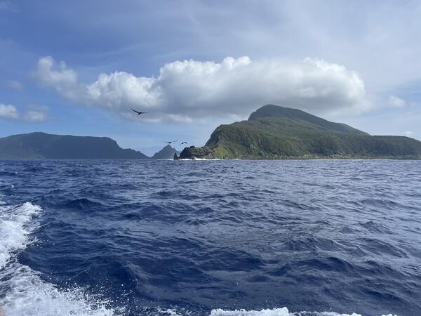
This photo, taken from a boat looking to the northwest, shows Olosega Island on the right and Ofu Island on the left in the distance. Together, they make up the top of Ofu-Olosega volcano, most of which is underwater. USGS photo by N. Deligne.
Sources/Usage: Public Domain. View Media Details
Media
Sources/Usage: Public Domain. View Media Details
Media
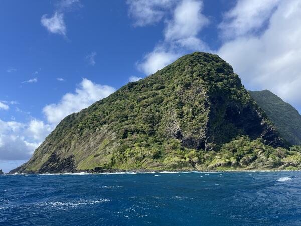
This photo, taken from a boat, shows the eastern side of Olosega Island in the Manuʻa Islands of American Samoa. This volcanic island is part of Ofu-Olosega volcano, which is estimated to be 440,000 years old. USGS photo by N. Deligne.
Sources/Usage: Public Domain. View Media Details
Media
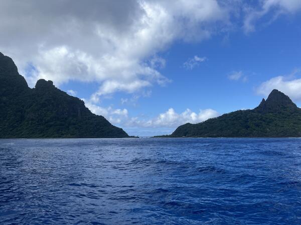
This photo, taken from a boat looking south, shows Olosega Island to the left, Ofu Island to the right, and the Asaga bridge connecting the two islands. The Asaga bridge was built in 1970; this single-lane bridge connects the two islands that form Ofu-Olosega volcano. USGS photo by N. Deligne.
Sources/Usage: Public Domain. View Media Details
Media
Sources/Usage: Public Domain. View Media Details