
Shrub Distribution Over the McDermitt Caldera Region
By Earth Resources Observation and Science (EROS) Center
2024 (approx.)
Detailed Description
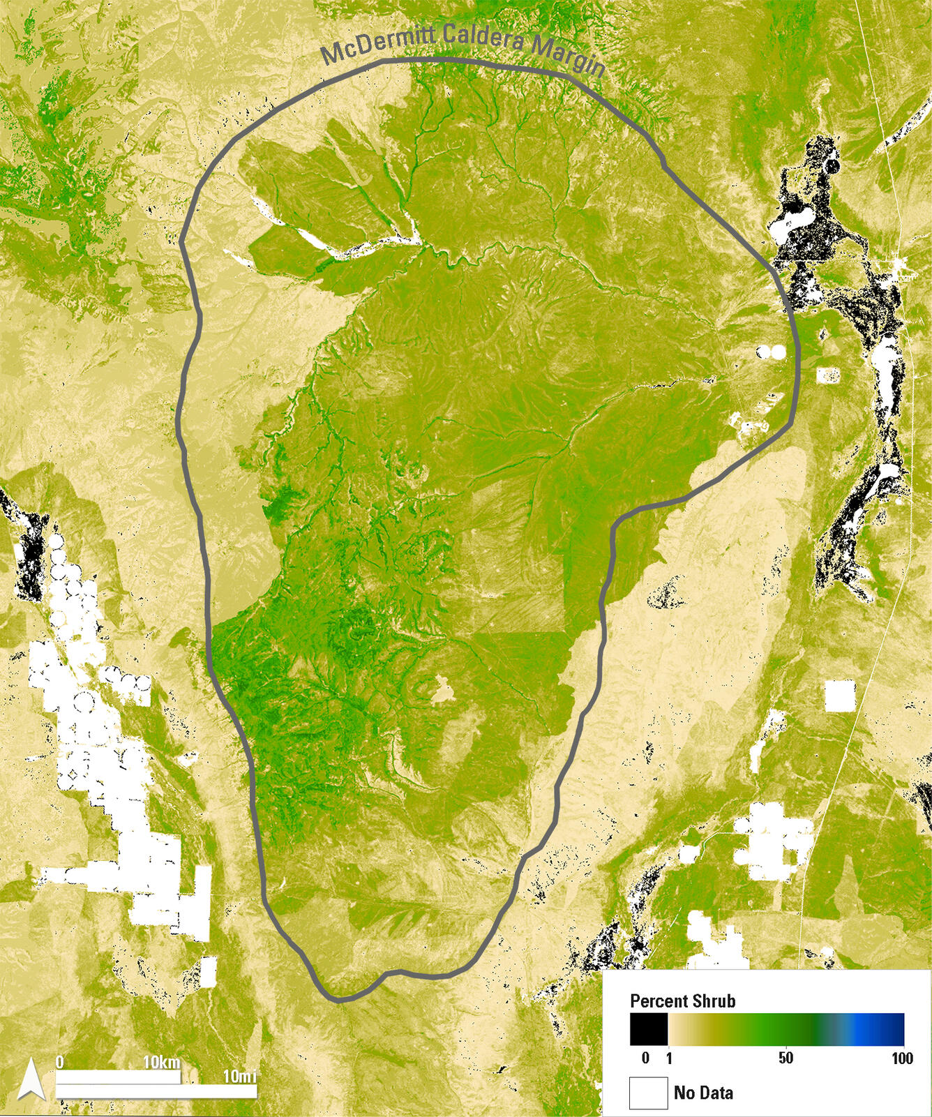
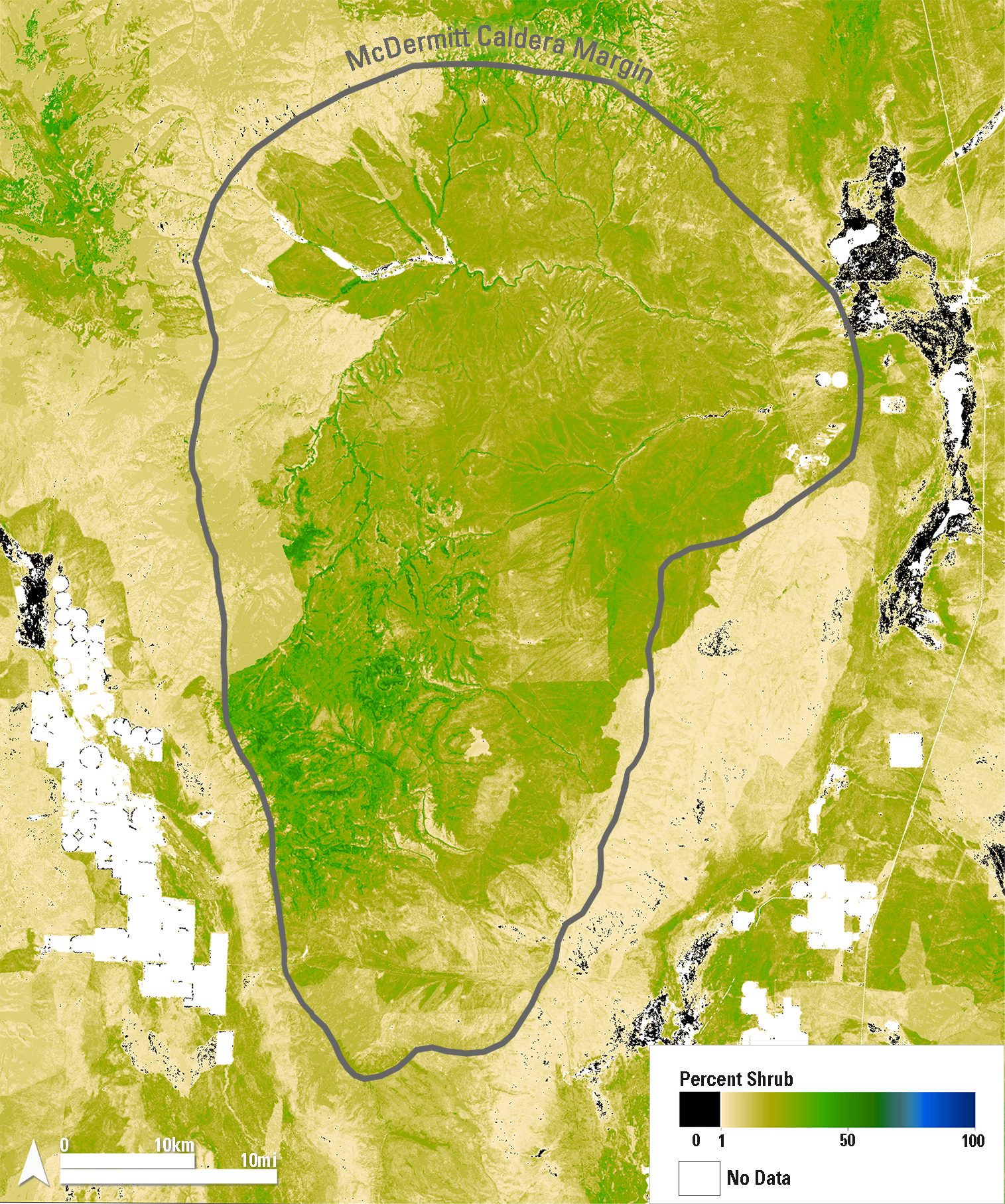
This map shows 2024 shrub cover from the Rangeland Condition Monitoring Assessment and Projection (RCMAP) project across the McDermitt Caldera, outlined in gray, along the Nevada–Oregon border. Dark green areas indicate high shrub cover, typically found in riparian zones and at higher elevations. Tan areas reflect low shrub cover, including recently burned regions where cover change is often abrupt. White areas represent non-rangeland cover types such as agriculture, water, or developed land.
Sources/Usage
Public Domain.