
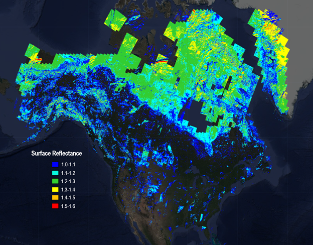
Spatial distribution of Landsat 8-9 C2 Surface Reflectance Band 4 values greater than one-March 2022

Detailed Description
This map displays the spatial distribution of the Landsat 8 and 9 Collection 2 Surface Reflectance Band 4 (Red) values > 1.0 from March 2022 over North America. The inappropriate AOT retrieval over snow/ice cover and the relatively high Solar Zenith Angle (SZA>60 degrees) in higher latitudes in March are primary reasons for extensive SR >1.0.
For more information about this known issue in Landsat Collection 2 Surface Reflectance data, please visit the Landsat Collection 2 Known Issues webpage.
Sources/Usage
Public Domain.