
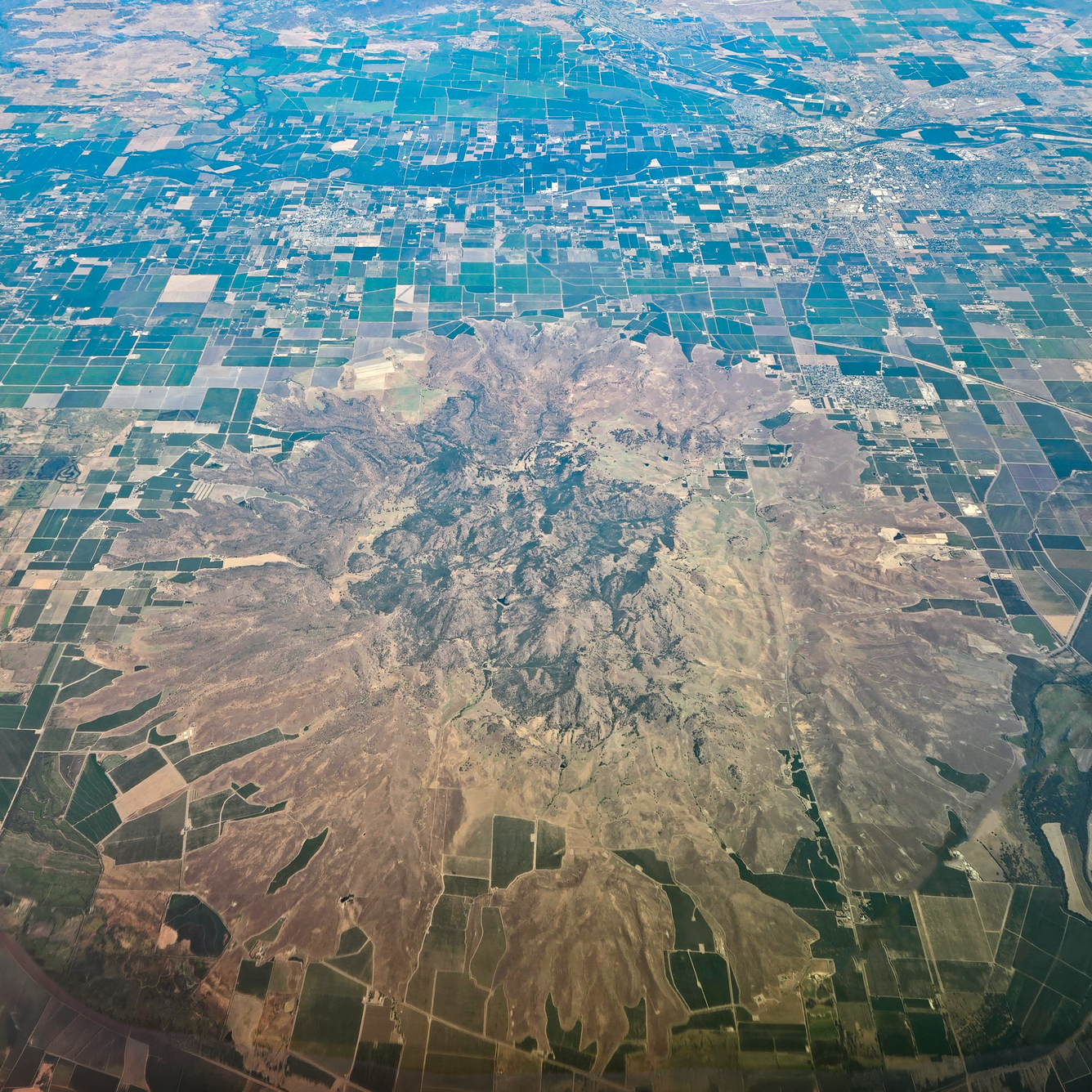
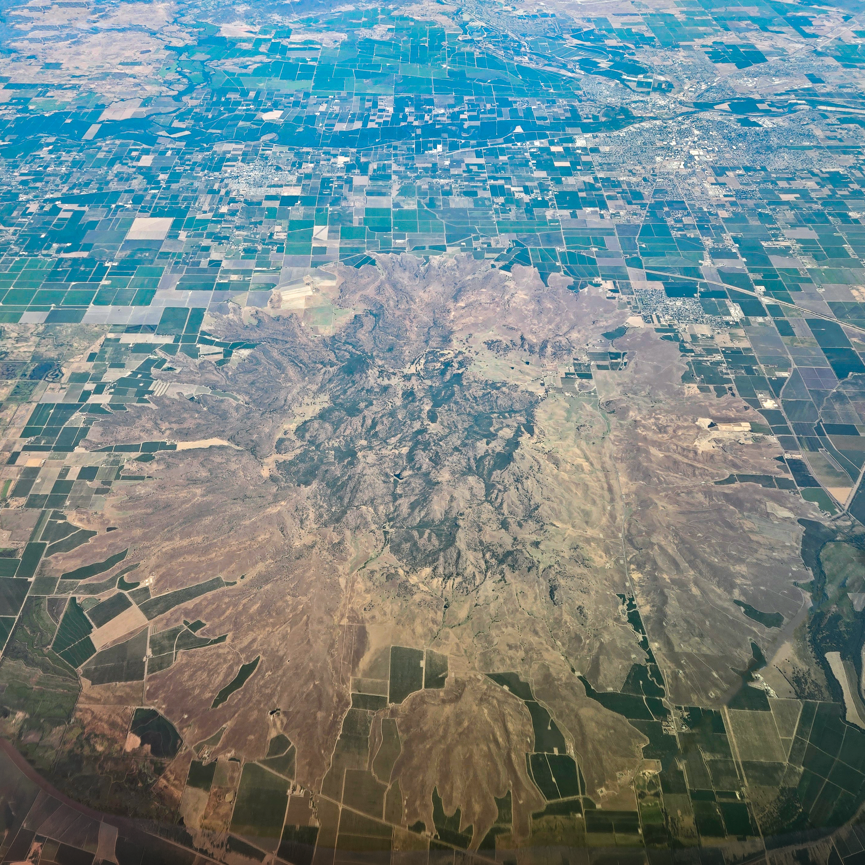
Sutter Buttes, California seen from the air
Altered Content -
This photo has been edited to remove the airplane wing and window and enhanced for clarity.
Detailed Description
This aerial photo, taken from about 40,000 feet and looking east, highlights the rugged central lava domes and smooth circular debris apron of the Sutter Buttes. USGS photo by J. Ball.
Sources/Usage
Public Domain.