
Terrestrial lidar and bathymetry survey of shoreline

Detailed Description
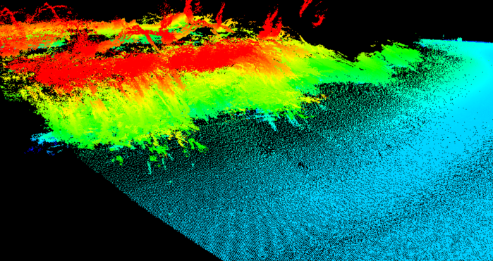
Example point cloud of lidar/bathymetry survey of a sloped bank covered with vegetation.
Sources/Usage
Public Domain.
Related

Pilot project to acquire and process terrestrial lidar and multibeam bathymetry to determine feasibility as a tool for US Army Corps of Engineers Habitat Restoration Enhancement Project (HREP) embankment assessment - McGregor Island
This project is an adaptive management and monitoring plan that encompasses technical assistance to the U.S. Army Corps of Engineers through University of Wisconsin – La Crosse (UW-L), U.S. Geological Survey (USGS) Upper Midwest Water Science Center and the USGS -Upper Midwest Environmental Sciences Center (USGS -UMESC).
Related
Pilot project to acquire and process terrestrial lidar and multibeam bathymetry to determine feasibility as a tool for US Army Corps of Engineers Habitat Restoration Enhancement Project (HREP) embankment assessment - McGregor Island
This project is an adaptive management and monitoring plan that encompasses technical assistance to the U.S. Army Corps of Engineers through University of Wisconsin – La Crosse (UW-L), U.S. Geological Survey (USGS) Upper Midwest Water Science Center and the USGS -Upper Midwest Environmental Sciences Center (USGS -UMESC).