
Tidal marsh aboveground carbon density maps
By Western Geographic Science Center
2018 (approx.)

Detailed Description
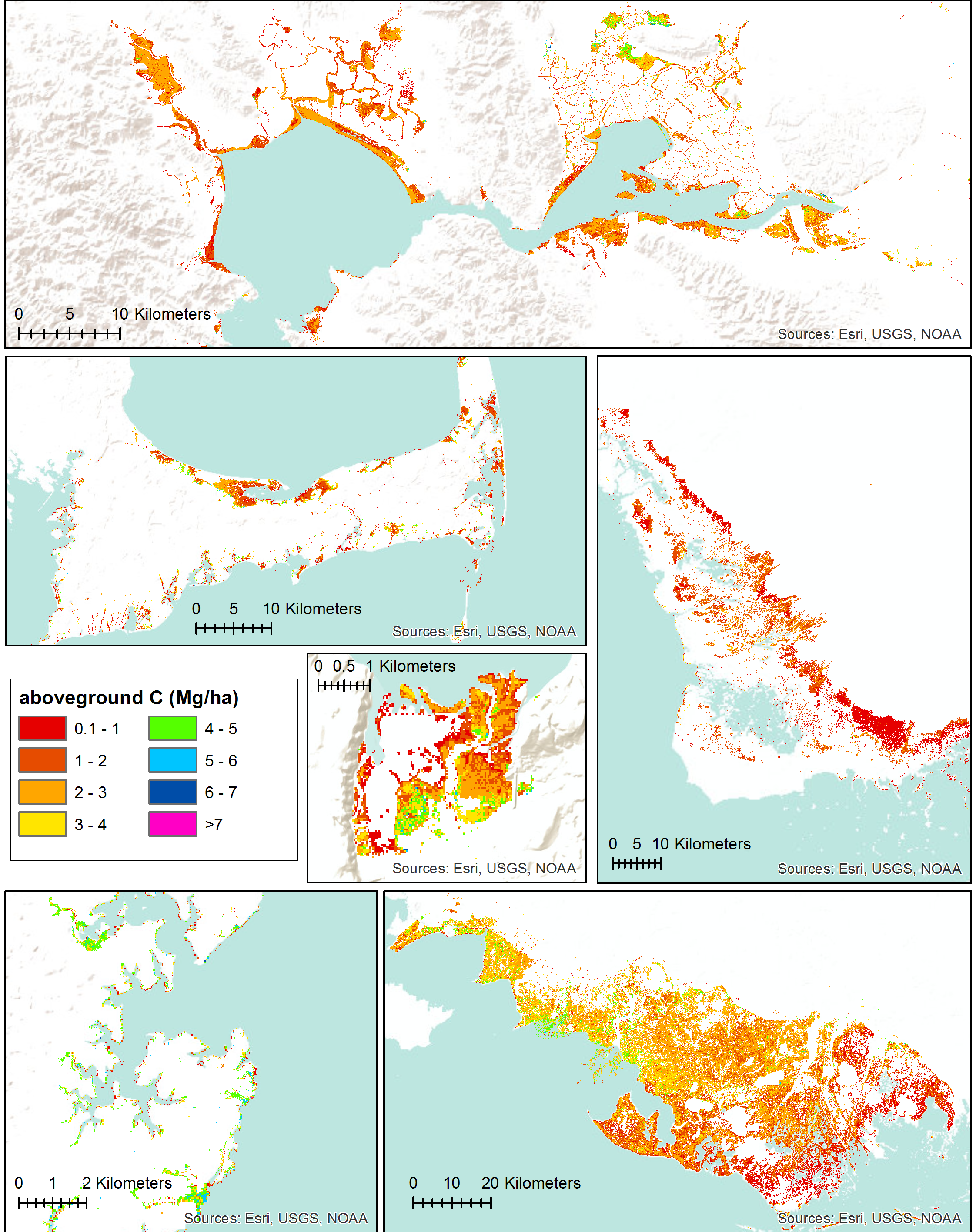
Tidal marsh aboveground carbon density maps of six study regions, based on the final biomass model and plant percent carbon content data (Byrd et al. 2018, ISPRS). Moving from top, left to right: San Francisco Bay, CA, Cape Cod, MA, Everglades, FL, Nisqually NWR, WA, Chesapeake Bay, MD, Terrebonne and St. Mary Parishes, LA.
Sources/Usage
Public Domain.
Related

Coastal Wetland Blue Carbon
The Coastal Wetland Blue Carbon research described below is conducted and managed under the USGS Applied Landscape Ecology and Remote Sensing project and partners.
Related
Coastal Wetland Blue Carbon
The Coastal Wetland Blue Carbon research described below is conducted and managed under the USGS Applied Landscape Ecology and Remote Sensing project and partners.