
Trail Transect to Measure Soil Loss

Detailed Description
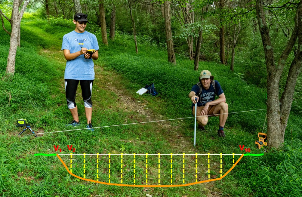
Field staff are establishing a permanent transect to measure changes in trail conditions along this trail. A self-leveling laser was used to set up the transect and the diagram illustrates how vertical measurements are collected to compute cross-sectional area soil loss measures.
Sources/Usage
Public Domain.