
Upper Mississippi River Basin Land Use and Cover
2016 (approx.)
Detailed Description
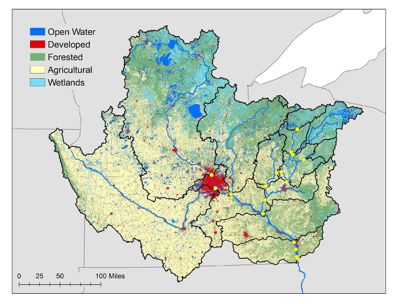
Figure 1b. Upper Mississippi River Basin land cover and land use. Yellow dots are 2015-17 study sampling locations. Creator: Britta Voss, 2016.
Sources/Usage
Public Domain.
Related

Water Quality Across Regional Stream Networks: The Influence of Land Cover and Land Use, Climate, and Biogeochemical Processing on Spatiotemporal Variance
Land cover and land use (LC/LU), climate, and biogeochemical processing are significant drivers of water quality in streams and rivers over broad scales of space and time. As LC/LU and climate continue to change we can expect changes in water quality. This project seeks to understand the drivers of spatial and temporal variability in water quality across scales using new and existing data to...
Related
Water Quality Across Regional Stream Networks: The Influence of Land Cover and Land Use, Climate, and Biogeochemical Processing on Spatiotemporal Variance
Land cover and land use (LC/LU), climate, and biogeochemical processing are significant drivers of water quality in streams and rivers over broad scales of space and time. As LC/LU and climate continue to change we can expect changes in water quality. This project seeks to understand the drivers of spatial and temporal variability in water quality across scales using new and existing data to...