
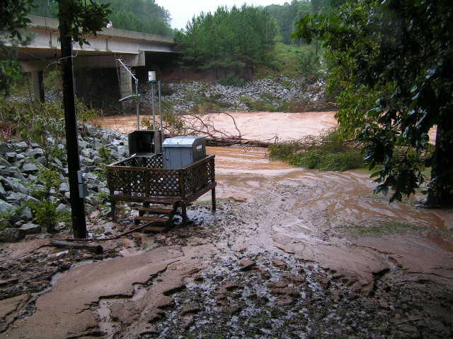
USGS Water-Monitoring Site at Dog River, Ga-Sept 2009 Floods
Detailed Description
The USGS water-monitoring site at Dog River at Ga 5, near Fariplay. The blue box contains stream stage (gage height) recording equipment. A buried pipe reaches from the gage into the river, allows the stage (depth) of the river to be measured. The aerial antenna transmits gage-height data back to the USGS office in Atlanta every 15-minute, with these data showing up on our Web pages in "real time". The white "can" on the pole is a tipping bucket rain gauge, that also measures precipitation in real-time. The USGS lost a number of gages and water quality monitoring stations during the September 2009 flooding around Atlanta.