
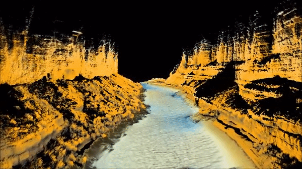
Visualization of map of riverbed and canyon walls in Grand Canyon
April 2016 (approx.)

Detailed Description
Visualization of map of riverbed and canyon walls near Navajo Bridge, 4.5 miles downstream from Lees Ferry, Arizona. River bathymetry was measured with multibeam sonar and topography was measured with a boat-mounted laser scanner. The data from this survey collected in April 2016 will be used to measure changes in sand storage on the river bed and to model streamflow and sand transport.
Sources/Usage
Public Domain.
Related

SBSC Tribal Partnerships
The Southwest Biological Science Center (SBSC) conducts and provides scientific information as part of our mission and Federal Trust Responsibility to strengthen relationships and build partnerships with sovereign tribal nations. Here, we highlight a few examples of projects with tribal partners.
Related
SBSC Tribal Partnerships
The Southwest Biological Science Center (SBSC) conducts and provides scientific information as part of our mission and Federal Trust Responsibility to strengthen relationships and build partnerships with sovereign tribal nations. Here, we highlight a few examples of projects with tribal partners.