
Woods Hole drone survey preparation

Detailed Description
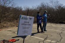
USGS Woods Hole Coastal and Marine Science Center UAS pilots Emily Sturdivant and Elizabeth Pendleton, teaming up to perform a drone survey taking images to be used for photogrammetry, and ultimately creating marsh surface models.
Sources/Usage
Public Domain.